


METADATA
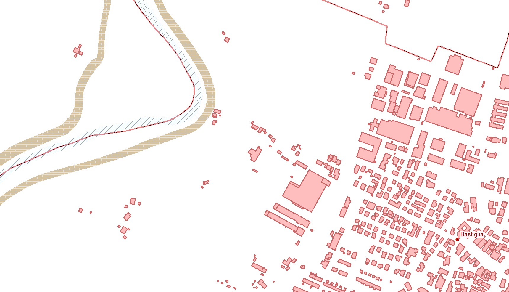
Serie di dati che affianca ed integra il Data Base Topografico (DBTR).Per informazioni sul DBTR: il documento normativo di riferimento per il progetto del Data Base Topografico è l’Atto di indirizzo e coordinamento tecnico per l’attuazione della Legg...
Regione Emilia-Romagna
Regione Emilia-Romagna
E-mail: archiviocart@regione.emilia-romagna.it
Website: https://geoportale.regione.emilia-romagna.it/archivio-cartografico/mapshop
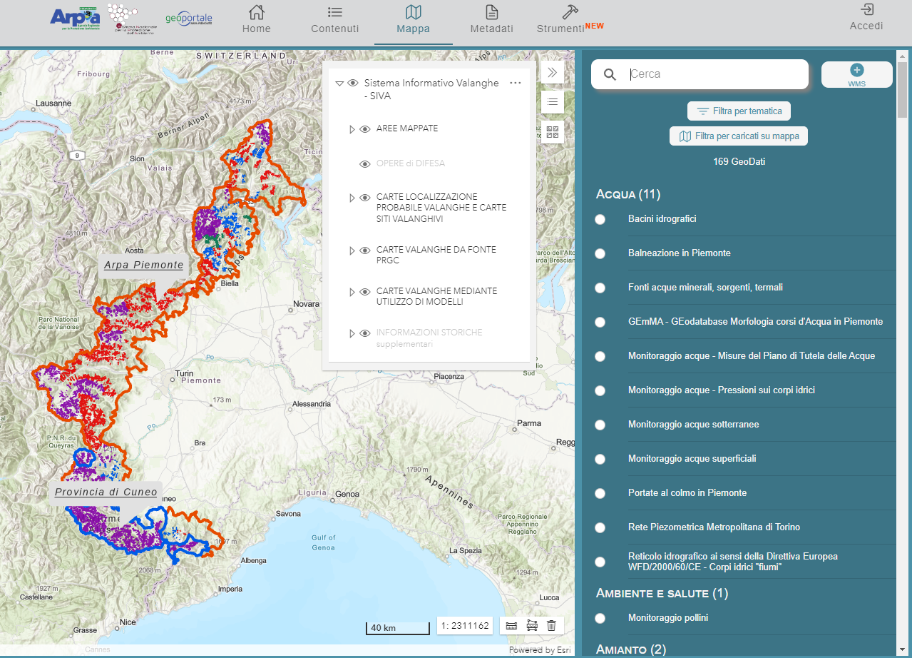
Scopo del servizio in rete è fornire un accesso diretto e guidato alla consultazione delle informazioni sulle problematiche valanghive nei territori montani. SIVA è uno strumento di analisi e consultazione di dati cartografici, data base alfanumerici, f...
Agenzia Regionale per la Protezione dell'Ambiente del Piemonte
Agenzia Regionale per la Protezione dell'Ambiente del Piemonte
E-mail: webgis@arpa.piemonte.it
Website: http://www.arpa.piemonte.it
Carta degli habitat della Regione Toscana, codificati secondo il sistema di classificazione europeo CORINE Biotopes (C.E.C. 1991), con adattamenti ed integrazioni- Dati di valutazione ecologico-ambientale: Indici di valore ecologico, sensibilità ecologic...
Istituto Superiore per la Protezione e la Ricerca Ambientale
ISPRA - Dipartimento monitoraggio e tutela dell’ambiente e conservazione della biodiversità
E-mail: cartanatura@isprambiente.it
Website: http://www.isprambiente.gov.it/it/servizi-per-lambiente/sistema-carta-della-natura

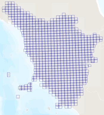
Ortofoto a copertura dell'intero territorio regionale realizzata con i fotogrammi del volo GAI degli anni 1954 1955 1956. L’ortorettifica del volo GAI è stata realizzata nell’ambito di un accordo di collaborazione scientifica tra la Regione Toscana e...
Regione Toscana
Regione Toscana - Settore Sistema Informativo e Pianificazione del Territorio
E-mail: contatto.cartografia@regione.toscana.it
LE AREE PERCORSE DAL FUOCO SONO RIFERITE AGLI EVENTI VERIFICATISI NEL 2019. SONO STATE RILEVATE DAL COMANDO REGIONE CARABINIERI FORESTALE "LIGURIA" ED ACQUISITE DAGLI UFFICI DEL MEDESIMO COMANDO. I DATI NON SONO VALIDI AI SENSI DEL COMMA 2, ART. 10 DELLA ...
Regione Liguria
Regione Liguria - Sportello cartografico
E-mail: infoter@regione.liguria.it
Website: https://geoportal.regione.liguria.it

LE AREE PERCORSE DAL FUOCO SONO RIFERITE AGLI EVENTI VERIFICATISI DAL 2003 FINO AL 2010. SONO STATE RILEVATE DAI COMANDI STAZIONE DEL CORPO FORESTALE DELLO STATO DELLA LIGURIA ED ACQUISITE DAGLI UFFICI DEL MEDESIMO CORPO FORESTALE. I DATI NON SONO VALIDI ...
Regione Liguria
Regione Liguria - INFORMATICA -
E-mail: infoter@regione.liguria.it
Website: https://geoportal.regione.liguria.it

Acquisizione su Sistema Informativo della Montagna, rilievi GPS e digitalizzazione su carta tecnica e/o carta catastale. Le aree percorse dal fuoco sono riferite agli eventi verificatisi nel 2020. Sono state rilevate dal Comando Regione Carabinieri Forest...
Regione Liguria
Regione Liguria - Sportello cartografico
E-mail: infoter@regione.liguria.it
Website: https://geoportal.regione.liguria.it

LE AREE PERCORSE DAL FUOCO SONO RIFERITE AGLI EVENTI VERIFICATISI NEL 2017. SONO STATE RILEVATE DAL COMANDO REGIONE CARABINIERI FORESTALE "LIGURIA" ED ACQUISITE DAGLI UFFICI DEL MEDESIMO COMANDO. I DATI NON SONO VALIDI AI SENSI DEL COMMA 2, ART. 10 DELLA ...
Regione Liguria
Regione Liguria - Sportello cartografico
E-mail: infoter@regione.liguria.it
Website: https://geoportal.regione.liguria.it

LE AREE PERCORSE DAL FUOCO SONO RIFERITE AGLI EVENTI VERIFICATISI NEL 2014. SONO STATE RILEVATE DAI COMANDI STAZIONE DEL CORPO FORESTALE DELLO STATO DELLA LIGURIA ED ACQUISITE DAGLI UFFICI DEL MEDESIMO CORPO FORESTALE. I DATI NON SONO VALIDI AI SENSI DEL ...
Regione Liguria
Regione Liguria - Sportello cartografico
E-mail: infoter@regione.liguria.it
Website: https://geoportal.regione.liguria.it

LE AREE PERCORSE DAL FUOCO SONO RIFERITE AGLI EVENTI VERIFICATISI NEL 2018. SONO STATE RILEVATE DAL COMANDO REGIONE CARABINIERI FORESTALE "LIGURIA" ED ACQUISITE DAGLI UFFICI DEL MEDESIMO COMANDO. I DATI NON SONO VALIDI AI SENSI DEL COMMA 2, ART. 10 DELLA ...
Regione Liguria
Regione Liguria - Sportello cartografico
E-mail: infoter@regione.liguria.it
Website: https://geoportal.regione.liguria.it

LE AREE PERCORSE DAL FUOCO SONO RIFERITE AGLI EVENTI VERIFICATISI NEL 2016. SONO STATE RILEVATE DAI COMANDI STAZIONE DEL CORPO FORESTALE DELLO STATO DELLA LIGURIA ED ACQUISITE DAGLI UFFICI DEL MEDESIMO CORPO FORESTALE. I DATI NON SONO VALIDI AI SENSI DEL ...
Regione Liguria
Regione Liguria - Sportello cartografico
E-mail: infoter@regione.liguria.it
Website: https://geoportal.regione.liguria.it

LE AREE PERCORSE DAL FUOCO SONO RIFERITE AGLI EVENTI VERIFICATISI NEL 2013. SONO STATE RILEVATE DAI COMANDI STAZIONE DEL CORPO FORESTALE DELLO STATO DELLA LIGURIA ED ACQUISITE DAGLI UFFICI DEL MEDESIMO CORPO FORESTALE. I DATI NON SONO VALIDI AI SENSI DEL ...
Regione Liguria
Regione Liguria - Sportello cartografico
E-mail: infoter@regione.liguria.it
Website: https://geoportal.regione.liguria.it

LE AREE PERCORSE DAL FUOCO SONO RIFERITE AGLI EVENTI VERIFICATISI NEL 2015. SONO STATE RILEVATE DAI COMANDI STAZIONE DEL CORPO FORESTALE DELLO STATO DELLA LIGURIA ED ACQUISITE DAGLI UFFICI DEL MEDESIMO CORPO FORESTALE. I DATI NON SONO VALIDI AI SENSI DEL ...
Regione Liguria
Regione Liguria - Sportello cartografico
E-mail: infoter@regione.liguria.it
Website: https://geoportal.regione.liguria.it

LE AREE PERCORSE DAL FUOCO SONO RIFERITE AGLI EVENTI VERIFICATISI NEL 2011. SONO STATE RILEVATE DAI COMANDI STAZIONE DEL CORPO FORESTALE DELLO STATO DELLA LIGURIA ED ACQUISITE DAGLI UFFICI DEL MEDESIMO CORPO FORESTALE. I DATI NON SONO VALIDI AI SENSI DEL ...
Regione Liguria
Regione Liguria - Sportello cartografico
E-mail: infoter@regione.liguria.it
Website: https://geoportal.regione.liguria.it

LE AREE PERCORSE DAL FUOCO SONO RIFERITE AGLI EVENTI VERIFICATISI NEL 2012. SONO STATE RILEVATE DAI COMANDI STAZIONE DEL CORPO FORESTALE DELLO STATO DELLA LIGURIA ED ACQUISITE DAGLI UFFICI DEL MEDESIMO CORPO FORESTALE. I DATI NON SONO VALIDI AI SENSI DEL ...
Regione Liguria
Regione Liguria - Sportello cartografico
E-mail: infoter@regione.liguria.it
Website: https://geoportal.regione.liguria.it
