Visualizza questa pagina nel portale RNDT
Information on Metadata
-
File Identifier: r_liguri:D.2666
-
Metadata Language: Italian
-
Metadata Character Set
utf8
-
Hierarchy level: Dataset
-
Metadata Responsibile:
-
Organization name: Regione Liguria - Sportello Cartografico
-
Role: Point Of Contact
-
Contact Info:
-
E-mail:
infoter@regione.liguria.it
-
Website: https://geoportal.regione.liguria.it
-
Metadata Date Stamp: 2025-06-12
-
Standard name: Linee guida RNDT
-
Standard version: 2.0
Reference System Information
-
Reference System Information: Monte-Mario-Italy1
Data information
-
Identifier: r_liguri:D.2666
-
Codespace/DOI: https://geoportal.regione.liguria.it
-
Series ID: r_liguri:D.2666
-
Abstract: La carta rappresenta le geometrie del Registro delle aree protette per la tutela delle acque, ai sensi dell'articolo 117 e dell'Allegato 9 della Parte Terza del D.lgs. 152/2006. Tale cartografia, parte integrante del Piano Regionale di Tutela delle Acque (P.T.A.), individua le zone del territorio la cui gestione richiede specifiche misure di salvaguardia, finalizzate alla protezione della qualità delle acque e alla conservazione degli habitat acquatici - Anno: 2025 - Copertura: Intero Territorio Regionale - Sistema proiezione: Gauss Boaga - Fuso Ovest - scala 1:10000
-
Language: Italian
-
Character set: UTF-8, 8-bit variable size UCS Transfer Format
-
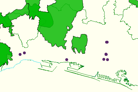
Thumbnail:
-
-
-
???catalog.schedaMetadati.thumbnail.url: https://srvcarto.regione.liguria.it/repertoriocartografico/images/sit/STR_REGISTROAREEPROTETTE.GIF
-
Information:
-
Title: P.T.A. 2025 - Registro aree protette per la tutela delle acque - Allegato 9 della parte III del D.lgs. 152/2006
-
Date:
-
-
Date 2025-01-01
-
Date Type Revision Date
-
Resource responsible:
-
Organization name: Regione Liguria
-
Role: Owner
-
Contact Info:
-
E-mail:
ecosistemacostieroeacque@regione.liguria.it
-
Website: https://geoportal.regione.liguria.it
-
Organization name: Regione Liguria - Settore Ecosistema costiero e acque - Direzione generale Ambiente
-
Role: Author
-
Contact Info:
-
E-mail:
ecosistemacostieroeacque@regione.liguria.it
-
Website: https://geoportal.regione.liguria.it
-
Contact point:
-
-
Organization name: Regione Liguria - Sportello cartografico
-
Role: Point Of Contact
-
Contact Info:
-
E-mail:
infoter@regione.liguria.it
-
Website: https://geoportal.regione.liguria.it
-
Presentation format: mapDigital
-
Type of spatial representation: Vectorial data
-
Equivalent Scale: 1:
10000
-
ISO topic categories:
- planning - Cadastre
-
Keywords:
-
-
Keyword: Regionale
-
Thesaurus:
-
Title: Spatial scope
-
Date:
-
-
Date 2019-05-22
-
Date Type Publication Date
-
Keyword: Protected sites
-
Thesaurus:
-
Title: GEMET - INSPIRE themes, version 1.0
-
Date:
-
-
Date 2008-06-01
-
Date Type Publication Date
-
Keyword: CARTE TEMATICHE
-
Keyword: PIANIFICAZIONE DEL TERRITORIO E CATASTO
-
Keyword: open data
-
Keyword: EU
-
Geographical area:
-
-
West Bounding Longitude 7.48820862370018
-
East Bounding Longitude 10.0879518636137
-
North Bounding Latitude 44.849579861466
-
South Bounding Latitude 43.5963597132668
-
Legal Constraints:
-
-
Access Contraints:
-
Other Constraints:
-
Legal Constraints:
-
-
Usage Constraints: Other Restrictions
-
Other Constraints:
-
Security Constraints:
-
-
Classification: unclassified
Distribution
-
Distribution Format:
-
-
Format Name
GeoPackage
-
Format Version
n.d.
-
Distribution Format:
-
-
Format Name
GML versione 3
-
Format Version
n.d.
-
Distribution Format:
-
-
Format Name
GML versione 2
-
Format Version
n.d.
-
Distribution Format:
-
-
Format Name
KML
-
Format Version
n.d.
-
Distribution Format:
-
-
Format Name
Shapefile
-
Format Version
n.d.
-
Distribution Format:
-
-
Format Name
Mapinfo
-
Format Version
n.d.
-
Transfer Options:
-
-
URL: https://srvcarto.regione.liguria.it/geoservices/apps/viewer/pages/apps/download/index.html?id=2666
-
Transfer Options:
-
-
URL: https://geoservizi.regione.liguria.it/geoserver/M2666/wfs?version=2.0.0&request=getcapabilities
-
Transfer Options:
-
-
URL: https://geoservizi.regione.liguria.it/geoserver/M2666/wms?version=1.3.0&request=getcapabilities
-
Distributor:
-
-
Distributor Contact:
-
-
Organization name: Regione Liguria - Sportello cartografico
-
Role: Distributor
-
Contact Info:
-
E-mail:
infoter@regione.liguria.it
-
Website: https://geoportal.regione.liguria.it
Quality
-
Quality level: Dataset
-
Conformity:
-
-
Conformity Level: false
-
Description: Fare riferimento alle specifiche indicate
-
Conformity:
-
-
Title: REGOLAMENTO (UE) N. 1089/2010 DELLA COMMISSIONE del 23 novembre 2010 recante attuazione della direttiva 2007/2/CE del Parlamento europeo e del Consiglio per quanto riguarda l'interoperabilità dei set di dati territoriali e dei servizi di dati territoriali
-
Date:
-
-
Date 2010-12-08
-
Date Type Publication Date
-
Positional accuracy:
-
-
Value:
m
2
m
-
Lineage: Digitalizzazione su Carta Tecnica Regionale