Visualizza questa pagina nel portale RNDT
Information on Metadata
-
File Identifier: r_liguri:D.1593
-
Metadata Language: Italian
-
Metadata Character Set
utf8
-
Hierarchy level: Dataset
-
Metadata Responsibile:
-
Organization name: Regione Liguria - Sportello Cartografico
-
Role: Point Of Contact
-
Contact Info:
-
E-mail:
infoter@regione.liguria.it
-
Website: https://geoportal.regione.liguria.it
-
Metadata Date Stamp: 2022-05-19
-
Standard name: Linee guida RNDT
-
Standard version: 2.0
Reference System Information
-
Reference System Information: Monte-Mario-Italy1
Data information
-
Identifier: r_liguri:D.1593
-
Codespace/DOI: https://geoportal.regione.liguria.it
-
Series ID: r_liguri:D.1593
-
Abstract: La classificazione tipologica della vegetazione si basa sulle caratteristiche delle singole specie contestualizzate nell'ambito del proprio ecosistema.
Le tipologie forestali rappresentano un mezzo operativo di inquadramento, che consente di fondare su presupposti ecologici e non solo fisionomici il governo del bosco: costituisce, quindi, un approccio funzionale e innovativo in grado di dare indicazioni sulla gestione appropriata dei boschi, tenuto conto delle diverse situazioni ambientali e dei servizi richiesti.
L'attività di fotointerpretazione è stata calibrata e verificata tramite campagne di rilievi a terra, per poter ottenere una più precisa classificazione delle tipologie vegetali.
Il livello informativo dei Punti di controllo a terra permette di visualizzare fotografie orientate, scattate durante i rilievi e di visionare note puntuali prese durante i sopralluoghi.
-
Language: Italian
-
Character set: UTF-8, 8-bit variable size UCS Transfer Format
-
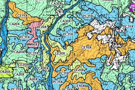
Thumbnail:
-
-
-
???catalog.schedaMetadati.thumbnail.url: https://srvcarto.regione.liguria.it/repertoriocartografico/images/sit/STR_TIPI_FORESTALI.GIF
-
Information:
-
Title: Tipi Forestali della Regione Liguria sc. 1:25000 - ed. 2013
-
Date:
-
-
Date 2013-01-01
-
Date Type Revision Date
-
Resource responsible:
-
Organization name: Regione Liguria
-
Role: Owner
-
Contact Info:
-
E-mail:
Federico.Marenco@regione.liguria.it
-
Website: https://geoportal.regione.liguria.it
-
Organization name: Regione Liguria - Politiche della natura e delle aree interne, protette e marine, parchi e biodiversità - Vice direzione generale agricoltura, risorse naturali, aree protette e interne
-
Role: Author
-
Contact Info:
-
E-mail:
Federico.Marenco@regione.liguria.it
-
Website: https://geoportal.regione.liguria.it
-
Contact point:
-
-
Organization name: Regione Liguria - Sportello cartografico
-
Role: Point Of Contact
-
Contact Info:
-
E-mail:
infoter@regione.liguria.it
-
Website: https://geoportal.regione.liguria.it
-
Presentation format: mapDigital
-
Type of spatial representation: Vectorial data
-
Equivalent Scale: 1:
25000
-
ISO topic categories:
- farming
-
Keywords:
-
-
Keyword: Regionale
-
Thesaurus:
-
Title: Spatial scope
-
Date:
-
-
Date 2019-05-22
-
Date Type Publication Date
-
Keyword: Land cover
-
Thesaurus:
-
Title: GEMET - INSPIRE themes, version 1.0
-
Date:
-
-
Date 2008-06-01
-
Date Type Publication Date
-
Keyword: CARTE TEMATICHE
-
Keyword: AGRICOLTURA
-
Keyword: open data
-
Keyword: EU
-
Geographical area:
-
-
West Bounding Longitude 7.48820862370018
-
East Bounding Longitude 10.0879518636137
-
North Bounding Latitude 44.849579861466
-
South Bounding Latitude 43.5963597132668
-
Other details and supplemental information:
-
Vedi documentazione all'indirizzo: https://srvcarto.regione.liguria.it/repertoriocartografico/documentazione/Tipi_forestali_RegioneLiguria_2013.pdf
-
Legal Constraints:
-
-
Access Contraints:
-
Other Constraints:
-
Legal Constraints:
-
-
Usage Constraints: Other Restrictions
-
Other Constraints:
-
Security Constraints:
-
-
Classification: unclassified
Distribution
-
Distribution Format:
-
-
Format Name
GML versione 3
-
Format Version
n.d.
-
Distribution Format:
-
-
Format Name
PDF di stampa
-
Format Version
n.d.
-
Distribution Format:
-
-
Format Name
Mapinfo
-
Format Version
n.d.
-
Distribution Format:
-
-
Format Name
KML
-
Format Version
n.d.
-
Distribution Format:
-
-
Format Name
GML versione 2
-
Format Version
n.d.
-
Distribution Format:
-
-
Format Name
GeoPackage
-
Format Version
n.d.
-
Distribution Format:
-
-
Format Name
JPG di stampa
-
Format Version
n.d.
-
Distribution Format:
-
-
Format Name
Shapefile
-
Format Version
n.d.
-
Transfer Options:
-
-
URL: https://geoservizi.regione.liguria.it/geoserver/M1593/wms?version=1.3.0&request=getcapabilities
-
Transfer Options:
-
-
URL: https://srvcarto.regione.liguria.it/geoservices/apps/viewer/pages/apps/download/index.html?id=1593
-
Transfer Options:
-
-
URL: https://geoservizi.regione.liguria.it/geoserver/M1593/wfs?version=2.0.0&request=getcapabilities
-
Distributor:
-
-
Distributor Contact:
-
-
Organization name: Regione Liguria - Sportello cartografico
-
Role: Distributor
-
Contact Info:
-
E-mail:
infoter@regione.liguria.it
-
Website: https://geoportal.regione.liguria.it
Quality
-
Quality level: Dataset
-
Conformity:
-
-
Conformity Level: false
-
Description: Fare riferimento alle specifiche indicate
-
Conformity:
-
-
Title: REGOLAMENTO (UE) N. 1089/2010 DELLA COMMISSIONE del 23 novembre 2010 recante attuazione della direttiva 2007/2/CE del Parlamento europeo e del Consiglio per quanto riguarda l'interoperabilità dei set di dati territoriali e dei servizi di dati territoriali
-
Date:
-
-
Date 2010-12-08
-
Date Type Publication Date
-
Positional accuracy:
-
-
Value:
m
5
m
-
Lineage: Fotoanalisi e fotointerpretazione di immagini digitali aeree ad alta risoluzione AGEA 2013 a colori naturali ed all'infrarosso.