Visualizza questa pagina nel portale RNDT
Information on Metadata
-
File Identifier: ingv:https://data.ingv.it/metadata/iso19115/1054.xml
-
Metadata Language: English
-
Metadata Character Set
utf8
-
Hierarchy level: Dataset
-
Metadata Responsibile:
-
Organization name: Istituto Nazionale di Geofisica e Vulcanologia - INGV
-
Role: Point Of Contact
-
Contact Info:
-
E-mail:
ufficiogestionedati@ingv.it
-
Website: http://istituto.ingv.it/it/ufficio-gestione-dati
-
Metadata Date Stamp: 2024-11-25
-
Standard name: Linee Guida RNDT
-
Standard version: 2.0
Reference System Information
-
Reference System Information: WGS84
Data information
-
Identifier: ingv:https://doi.org/10.13127/efsm20/meshes
-
Series ID: ingv:https://doi.org/10.13127/efsm20/meshes
-
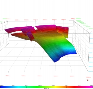
Abstract: EFSM20-Meshes was designed to provide the users of the European Fault-Source Model 2020 (EFSM20) with 3D geometric realizations of the fault sources made by triangular meshes. Triangular meshes are useful for several applications of earthquake modelling that require a discretization of the fault plane, e.g., heterogeneous slip distributions. EFSM20-Meshes was created to fulfil the objectives of the Geo-INQUIRE project and is hosted, maintained, and distributed by INGV through the EDSF installation (https://seismofaults.eu/) operated under the auspices of the EPOS-ERIC, TCS EPOS-Seismology, EFEHR Consortium, and the EPOS-MIUR Joint Research Unit.
-
Language: English
-
Character set: UTF-8, 8-bit variable size UCS Transfer Format
-
Thumbnail:
-
-
-
???catalog.schedaMetadati.thumbnail.url: https://data.ingv.it/dataset/cover/1054.jpg
-
???catalog.schedaMetadati.thumbnail.type:
image/jpeg
-
???catalog.schedaMetadati.thumbnail.description:
thumbnail
-
Information:
-
Title: European Fault-Source Model 2020 (EFSM20): 3D triangular meshes
-
Alternate Title: EFSM20-Meshes
-
Date:
-
-
Date 2024-11-04
-
Date Type Publication Date
-
Resource responsible:
-
Organization name: Istituto Nazionale di Geofisica e Vulcanologia - INGV
-
Role: Owner
-
Contact Info:
-
E-mail:
ufficiogestionedati@ingv.it
-
Website: http://www.ingv.it
-
Organization name: Istituto Nazionale di Geofisica e Vulcanologia - INGV
-
Role: Resource Provider
-
Contact Info:
-
E-mail:
ufficiogestionedati@ingv.it
-
Website: http://istituto.ingv.it/it/ufficio-gestione-dati
-
Organization name: Istituto Nazionale di Geofisica e Vulcanologia - INGV
-
Role: Publisher
-
Contact Info:
-
E-mail:
ufficiogestionedati@ingv.it
-
Website: http://istituto.ingv.it/it/ufficio-gestione-dati
-
Individual Name: Basili, Roberto
-
Organization name: Istituto Nazionale di Geofisica e Vulcanologia (INGV)
-
Role: Author
-
Contact Info:
-
E-mail:
roberto.basili@ingv.it
-
Website: https://orcid.org/0000-0002-1213-0828
-
Individual Name: Taccone, Rita Chiara
-
Organization name: Istituto Nazionale di Geofisica e Vulcanologia (INGV)
-
Role: Author
-
Contact Info:
-
E-mail:
ritachiara.taccone@ingv.it
-
Website: https://orcid.org/0000-0002-1048-6118
-
Individual Name: Vallone, Roberto
-
Organization name: Istituto Nazionale di Geofisica e Vulcanologia (INGV)
-
Role: Author
-
Contact Info:
-
E-mail:
roberto.vallone@ingv.it
-
Website: https://orcid.org/0000-0003-1208-9412
-
Individual Name: Maesano, Francesco
-
Organization name: Istituto Nazionale di Geofisica e Vulcanologia (INGV)
-
Role: Author
-
Contact Info:
-
E-mail:
francesco.maesano@ingv.it
-
Website: https://orcid.org/0000-0002-5652-1548
-
Contact point:
-
-
Individual Name: Basili, Roberto
-
Organization name: Istituto Nazionale di Geofisica e Vulcanologia - INGV
-
Role: Point Of Contact
-
Contact Info:
-
E-mail:
roberto.basili@ingv.it
-
Website: https://orcid.org/0000-0002-1213-0828
-
Presentation format: Digital model
-
Update frequency: Not planned
-
Type of spatial representation: Vectorial data
-
Equivalent Scale: 1:
1000
-
ISO topic categories:
- geoscientific Information
-
Keywords:
-
-
Keyword: EU
-
Keyword: open data
-
Keyword: European
-
Thesaurus:
-
Title: Spatial scope
-
Date:
-
-
Date 2019-05-22
-
Date Type Publication Date
-
Keyword: SCIENCE.natural and applied sciences.earth sciences.geology.geophysics
-
Keyword: SCIENCE.natural and applied sciences.earth sciences.geology.seismology
-
Keyword: SCIENCE.natural and applied sciences.earth sciences.hazard science
-
Thesaurus:
-
Title: EuroVoc
-
Date:
-
-
Date 2024-11-25T19:11:00
-
Date Type Publication Date
-
Keyword: Natural risk zones
-
Thesaurus:
-
Title: GEMET - INSPIRE themes, version 1.0
-
Date:
-
-
Date 2008-06-01
-
Date Type Publication Date
-
Keyword: model of seismogenic faults
-
Keyword: Europe
-
Keyword: earthquakes
-
Keyword: magnitude
-
Keyword: slip rate
-
Keyword: crustal fault sources
-
Keyword: subduction fault sources
-
Keyword: hazard model
-
Keyword: Earth Sciences and Geology
-
Keyword: QE - Geology
-
Keyword: 551 Geology, hydrology, meteorology
-
Keyword: 554 Earth sciences of Europe
-
Keyword: 555 Earth sciences of Asia
-
Keyword: 556 Earth sciences of Africa
-
Geographical area:
-
-
West Bounding Longitude -46.95
-
East Bounding Longitude 53.46
-
North Bounding Latitude 82.87
-
South Bounding Latitude 15.24
-
Use Limitation: http://publications.europa.eu/resource/authority/licence/CC_BY
-
Legal Constraints:
-
-
Usage Constraints: Other Restrictions
-
Other Constraints:
-
Legal Constraints:
-
-
Access Contraints:
-
Other Constraints:
-
Security Constraints:
-
-
Classification: unclassified
Distribution
-
Distribution Format:
-
-
Format Name
WFS
-
Format Version
OGC Web Feature Service (WFS)
-
Transfer Options:
-
-
URL: https://seismofaults.eu/efsm20
-
Transfer Options:
-
-
URL: https://services.seismofaults.eu/EFSM20_Meshes/ows?service=WFS&request=getCapabilities
-
Distributor:
-
-
Distributor Contact:
-
-
Organization name: Istituto Nazionale di Geofisica e Vulcanologia (INGV)
-
Role: Distributor
-
Contact Info:
-
E-mail:
ufficiogestionedati@ingv.it
-
Website: http://www.ingv.it
Quality
-
Quality level: Dataset
-
Conformity:
-
-
Conformity Level: true
-
Description: This data set is conformant with the INSPIRE Implementing Rules for the interoperability of spatial data sets and services
-
Conformity:
-
-
Title: Commission Regulation (EU) No 1089/2010 of 23 November 2010 implementing Directive 2007/2/EC of the European Parliament and of the Council as regards interoperability of spatial data sets and services
-
Date:
-
-
Date 2010-12-08
-
Date Type Publication Date
-
Positional accuracy:
-
-
Value:
m
1
m
-
Lineage: EFSM20-Meshes is derived from the European Fault-Source Model 2020 (EFSM20), and its compilation aims to replicate the geometry of its fault sources with triangular meshes as closely as possible. The adopted procedure includes the following steps. 1) extract triplets of spatial coordinates (latitude, longitude, depth) of evenly spaced points resting on the EFSM20 fault planes; 2) obtain triangles through Delauney triangulation; 3) remove spurious triangles. The results of this procedure can be replicated through a dedicated PyQGIS tool.