Visualizza questa pagina nel portale RNDT
Information on Metadata
-
File Identifier: assapcbz:Hazards:EventsRegister-Avalanches
-
Metadata Language: Italian
-
Metadata Character Set utf8
-
Parent ID:
-
Hierarchy level: Dataset
-
Metadata Responsibile:
-
Organization name: Ufficio Centro funzionale provinciale
-
Role: Point Of Contact
-
Contact Info:
-
Phone: +39 0471 41 45 68
-
E-mail: zs-browser@provincia.bz.it zs-browser@provincia.bz.it zs-browser@provinz.bz.it
-
Website: https://www.provincia.bz.it/it/contatti.asp?orga_orgaid=5996
-
Metadata Date Stamp: 2024-06-06
-
Standard name: Linee Guida RNDT
-
Standard version: 2.0
Reference System Information
-
Reference System Information: ETRS89/ETRS-TM32
Data information
-
Identifier: assapcbz:Hazards:EventsRegister-Avalanches
-
Series ID: assapcbz:Hazards:EventsRegister-Avalanches
-
Abstract: Catasto degli eventi valanghivi (LAKA)
-
Language: Italian
-
Character set: UTF-8, 8-bit variable size UCS Transfer Format
-
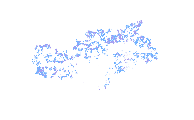
Thumbnail:
-
-
-
???catalog.schedaMetadati.thumbnail.url: https://geoservices2.civis.bz.it/geoserver/pczs-Hazards/ows?SERVICE=WMS&VERSION=1.1.1&REQUEST=GetMap&FORMAT=image/png&TRANSPARENT=true&LAYERS=EventsRegister-Avalanches&exceptions=application/vnd.ogc.se_inimage&SRS=EPSG:25832&STYLES=&WIDTH=769&HEIGHT=476&BBOX=568665.6809273337,5097834.342663296,803217.3688715831,5243207.524253741
-
???catalog.schedaMetadati.thumbnail.description: WMS GetMap
-
Information:
-
Title: Catasto degli eventi valanghivi e alluvionali
-
Date:
-
-
Date 2019-12-18
-
Date Type Creation Date
-
Date:
-
-
Date 2019-12-18
-
Date Type Publication Date
-
Resource responsible:
-
Organization name: Agenzia per la Protezione civile
-
Role: Owner
-
Contact Info:
-
Phone: +39 0471 416000
-
E-mail: protezionecivile@provincia.bz.it protezionecivile@provincia.bz.it bevoelkerungsschutz@provinz.bz.it
-
Website: https://appc.provincia.bz.it/default.asp
-
Organization name: Agenzia per la Protezione civile
-
Role: Author
-
Contact Info:
-
Phone: +39 0471 416000
-
E-mail: protezionecivile@provincia.bz.it protezionecivile@provincia.bz.it bevoelkerungsschutz@provinz.bz.it
-
Website: https://appc.provincia.bz.it/default.asp
-
Contact point:
-
-
Organization name: Ufficio Centro funzionale provinciale
-
Role: Point Of Contact
-
Contact Info:
-
Phone: +39 0471 41 45 68
-
Fax:
-
E-mail: zs-browser@provincia.bz.it zs-browser@provincia.bz.it zs-browser@provinz.bz.it
-
Website: https://www.provincia.bz.it/it/contatti.asp?orga_orgaid=5996
-
Presentation format:
-
Update frequency: When needed
-
Type of spatial representation: Vectorial data
-
Equivalent Scale: 1: 5000
-
ISO topic categories:
- geoscientific Information
-
Keywords:
-
-
Keyword: Regionale
-
Thesaurus:
-
Title: Spatial scope
-
Date:
-
-
Date 2019-05-22
-
Date Type Publication Date
-
Keyword: National legislation
-
Thesaurus:
-
Title: INSPIRE priority data set
-
Date:
-
-
Date 2018-04-04
-
Date Type Publication Date
-
Keyword: Informazioni geoscientifiche
-
Thesaurus:
-
Title: Topic categories in accordance with EN ISO 19115
-
Date:
-
-
Date 2021-09-20
-
Date Type Publication Date
-
Keyword: Zone a rischio naturale
-
Thesaurus:
-
Title: GEMET - INSPIRE themes, version 1.0
-
Date:
-
-
Date 2008-06-01
-
Date Type Publication Date
-
Keyword: Pericolo idrogeologico
-
Keyword: Pericolo idraulico
-
Keyword: Localizzazione degli eventi
-
Keyword: Colata detritica
-
Keyword: Alluvione
-
Keyword: Catasto eventi
-
Keyword: Evento valanghivo
-
Keyword: Documentazione evento
-
Keyword: Eventi naturali
-
Keyword: Evento naturale
-
Keyword: Pericoli naturali
-
Keyword: Pericolo naturale
-
Keyword: Valanga
-
Keyword: Valanghe
-
Keyword: Ambiente
-
Keyword: EU
-
Geographical area:
-
-
West Bounding Longitude 10.29
-
East Bounding Longitude 12.51
-
North Bounding Latitude 47.14
-
South Bounding Latitude 46.18
-
Legal Constraints:
-
-
Access Contraints:
-
Other Constraints:
-
Legal Constraints:
-
-
Usage Constraints: Other Restrictions
-
Other Constraints: https://creativecommons.org/publicdomain/zero/1.0/deed.it
Distribution
-
Distribution Format:
-
-
Format Name WMS
-
Format Version 1.3.0
-
Transfer Options:
-
-
URL: https://geoservices2.civis.bz.it/geoserver/pczs-Hazards/ows?service=WMS&version=1.3.0&request=GetCapabilities
-
Transfer Options:
-
-
URL: https://pericoli-naturali.provincia.bz.it/it/valanghe-catasto-degli-eventi-valanghivi-laka
-
Transfer Options:
-
-
URL: https://naturgefahren.provinz.bz.it/de/valanghe-catasto-degli-eventi-valanghivi-laka
-
Distributor:
-
-
Distributor Contact:
-
-
Organization name: Ufficio Pianificazione territoriale e cartografia
-
Role: Distributor
-
Contact Info:
-
Phone: +39 0471 417820
-
E-mail: cartografia@provincia.bz.it cartografia@provincia.bz.it kartografie@provinz.bz.it
-
Website: https://www.provincia.bz.it/natura-ambiente/natura-territorio/cartografia-provinciale-coordinamento-geodati.asp
Quality
-
Quality level: Dataset
-
Conformity:
-
-
Conformity Level: true
-
Description: Conforme
-
Conformity:
-
-
Title: REGOLAMENTO (UE) N. 1089/2010 DELLA COMMISSIONE del 23 novembre 2010 recante attuazione della direttiva 2007/2/CE del Parlamento europeo e del Consiglio per quanto riguarda l'interoperabilità dei set di dati territoriali e dei servizi di dati territoriali
-
Date:
-
-
Date 2010-12-08
-
Date Type Publication Date
-
Positional accuracy:
-
-
Value: m 1 m
-
Lineage: Il catasto degli eventi valanghivi viene gestito dall'Agenzia per la Protezione civile.