Visualizza questa pagina nel portale RNDT
Information on Metadata
-
File Identifier: r_vda:04392-META:20240119:152500
-
Metadata Language: Italian
-
Metadata Character Set utf8
-
Parent ID: r_vda:04392-META:20240119:152500
-
Hierarchy level: Dataset
-
???catalog.mdParam.rndt.general.hierarchyLevelName Dataset
-
Metadata Responsibile:
-
Organization name: RAVDA - Ufficio Cartografico
-
Role: Point Of Contact
-
Contact Info:
-
Phone: 0165 272501
-
E-mail: u-cartografia@regione.vda.it
-
Website: https://geoportale.regione.vda.it
-
Metadata Date Stamp: 2024-01-19
-
Standard name: Linee Guida RNDT
-
Standard version: 2.0
Reference System Information
-
Reference System Information: ED50-UTM32N
Data information
-
Identifier: r_vda:04392-DATA
-
Series ID: r_vda:04392-DATA
-
Abstract: Il Modello Digitale del Terreno (DTM) - edizione 1999 è stato ricavato estraendo dalla Carta Tecnica Regionale Numerica a grande scala, le informazioni relative ai punti quotati ed alle isolinee, nonché ai punti significativi per l’altimetria. Tali elementi hanno permesso di ottenere un seminato di punti che, opportunamente interpolati, hanno permesso la creazione diretta del Modello Digitale del Terreno (DTM) - edizione 1999.
-
Language: Italian
-
Character set: UTF-8, 8-bit variable size UCS Transfer Format
-
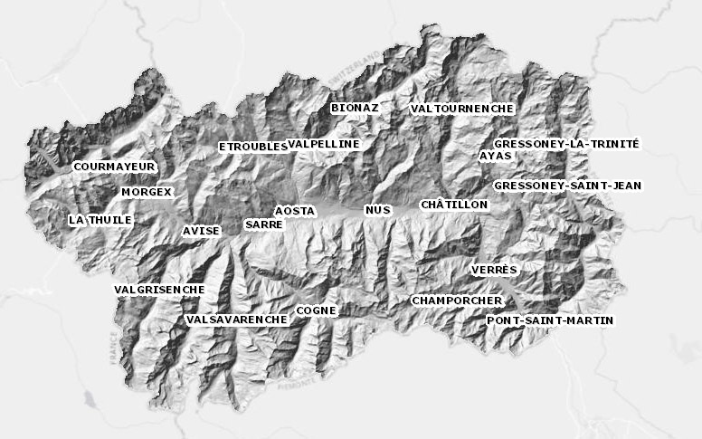
Thumbnail:
-
-
-
???catalog.schedaMetadati.thumbnail.url: https://metadati.partout.it/metadata_images/dtm_dsm.jpg
-
???catalog.schedaMetadati.thumbnail.type: jpg
-
???catalog.schedaMetadati.thumbnail.description: large_thumbnail
-
Information:
-
Title: Modello digitale del terreno: edizione 1999 - DTM passo 10, 25, 50 e 100
-
Date:
-
-
Date 2022-10-04
-
Date Type Creation Date
-
Date:
-
-
Date 2022-10-04
-
Date Type Publication Date
-
Date:
-
-
Date 2024-01-19
-
Date Type Revision Date
-
Resource responsible:
-
Organization name: Regione Autonoma Valle d'Aosta
-
Role: Owner
-
Contact Info:
-
Phone: 0165 272501
-
E-mail: u-cartografia@regione.vda.it
-
Website: https://geoportale.regione.vda.it/
-
Contact point:
-
-
Organization name: RAVDA - Ufficio cartografico
-
Role: Point Of Contact
-
Contact Info:
-
Phone: 0165 272501
-
E-mail: u-cartografia@regione.vda.it
-
Website: https://geoportale.regione.vda.it/
-
Presentation format: modelDigital
-
Update frequency: Not planned
-
Type of spatial representation: Raster data
-
ISO topic categories:
- elevation
- imagery BaseMaps EarthCover
-
Keywords:
-
-
Keyword: Elevazione
-
Thesaurus:
-
Title: GEMET - INSPIRE themes, version 1.0
-
Date:
-
-
Date 2008-06-01
-
Date Type Publication Date
-
Keyword: modello digitale del territorio
-
Thesaurus:
-
Title: GEMET - Concepts, version 2.4
-
Date:
-
-
Date 2019-01-28
-
Date Type Publication Date
-
Keyword: Regionale
-
Thesaurus:
-
Title: Spatial scope
-
Date:
-
-
Date 2019-05-22
-
Date Type Publication Date
-
Keyword: open data
-
Geographical area:
-
-
West Bounding Longitude 6.7979
-
East Bounding Longitude 7.9459
-
North Bounding Latitude 45.9932
-
South Bounding Latitude 45.4583
-
Temporal Extent:
-
-
Begin Date 2012-01-01
-
End Date 2030-12-31
-
Legal Constraints:
-
-
Access Contraints:
-
Other Constraints:
-
Legal Constraints:
-
-
Usage Constraints: Other Restrictions
-
Other Constraints: https://metadati.partout.it/metadata_documents/CC_BY_DTM_v2.pdf
Distribution
-
Distribution Format:
-
-
Format Name geo+json
-
Format Version 1.0
-
Transfer Options:
-
-
URL: https://mappe.regione.vda.it/pub/geonavitg/geodownload.asp?carta=DTM99
-
Distributor:
-
-
Distributor Contact:
-
-
Organization name: Ufficio Cartografico - Centro Diffusione Conoscenze Territoriali
-
Role: Distributor
-
Contact Info:
-
Phone: 0165 272501
-
E-mail: u-cartografia@regione.vda.it
-
Website: https://geoportale.regione.vda.it/
Quality
-
Quality level: Dataset
-
Conformity:
-
-
Conformity Level: Not evaluated
-
Description: Fare riferimento alle specifiche indicate
-
Conformity:
-
-
Title: REGOLAMENTO (UE) N. 1089/2010 DELLA COMMISSIONE del 23 novembre 2010 recante attuazione della direttiva 2007/2/CE del Parlamento europeo e del Consiglio per quanto riguarda l'interoperabilità dei set di dati territoriali e dei servizi di dati territoriali
-
Date:
-
-
Date 2010-12-08
-
Date Type Publication Date
-
Positional accuracy:
-
-
Value: m 0.50 m
-
Lineage: Il Modello Digitale del Terreno (DTM) - edizione 1999 è stato ricavato estraendo dalla Carta Tecnica Regionale Numerica a grande scala, le informazioni relative ai punti quotati ed alle isolinee, nonché ai punti significativi per l’altimetria. Tali elementi hanno permesso di ottenere un seminato di punti che, opportunamente interpolati, hanno permesso la creazione diretta del Modello Digitale del Terreno (DTM) - edizione 1999.