Visualizza questa pagina nel portale RNDT
Information on Metadata
-
File Identifier: r_vda:04388-META:20240110:165000
-
Metadata Language: Italian
-
Metadata Character Set utf8
-
Parent ID: r_vda:04388-META:20240110:165000
-
Hierarchy level: Dataset
-
???catalog.mdParam.rndt.general.hierarchyLevelName Dataset
-
Metadata Responsibile:
-
Organization name: RAVDA - Ufficio Cartografico
-
Role: Point Of Contact
-
Contact Info:
-
Phone: 0165 272501
-
E-mail: u-cartografia@regione.vda.it
-
Website: https://geoportale.regione.vda.it
-
Metadata Date Stamp: 2024-01-10
-
Standard name: Linee Guida RNDT
-
Standard version: 2.0
Reference System Information
-
Reference System Information: ED50-UTM32N
Data information
-
Identifier: r_vda:04388-DATA
-
Series ID: r_vda:04388-DATA
-
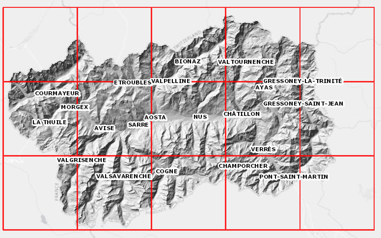
Abstract: Dato realizzato in coordinate WGS 84 / UTM zone 32N e quota ellissoidica. Il Modello digitale del terreno 2005/2008 (aggregato) a passo 10 metri è stato ricavato degradando a passo 10 metri il Modello digitale del terreno 2005/2008 a passo 2 metri.
-
Language: Italian
-
Character set: UTF-8, 8-bit variable size UCS Transfer Format
-
Thumbnail:
-
-

-
???catalog.schedaMetadati.thumbnail.url: https://metadati.partout.it/metadata_images/dtm_dsm_passo_10_ellis_orto.jpg
-
???catalog.schedaMetadati.thumbnail.type: jpg
-
???catalog.schedaMetadati.thumbnail.description: large_thumbnail
-
Information:
-
Title: Modello digitale del terreno: edizione 2005/2008 - DTM passo 10 aggregato in quota ellissoidica
-
Date:
-
-
Date 2024-01-10
-
Date Type Creation Date
-
Date:
-
-
Date 2024-01-10
-
Date Type Publication Date
-
Resource responsible:
-
Organization name: Regione Autonoma Valle d'Aosta
-
Role: Owner
-
Contact Info:
-
Phone: 0165 272501
-
E-mail: u-cartografia@regione.vda.it
-
Website: https://geoportale.regione.vda.it/
-
Organization name: RAVDA - Ufficio cartografico
-
Role: Author
-
Contact Info:
-
Phone: 0165 272501
-
E-mail: u-cartografia@regione.vda.it
-
Website: https://geoportale.regione.vda.it/
-
Contact point:
-
-
Organization name: RAVDA - Ufficio cartografico
-
Role: Point Of Contact
-
Contact Info:
-
Phone: 0165 272501
-
E-mail: u-cartografia@regione.vda.it
-
Website: https://geoportale.regione.vda.it/
-
Presentation format: modelDigital
-
Update frequency: Not planned
-
Type of spatial representation: Raster data
-
ISO topic categories:
- elevation
- imagery BaseMaps EarthCover
-
Keywords:
-
-
Keyword: Elevazione
-
Thesaurus:
-
Title: GEMET - INSPIRE themes, version 1.0
-
Date:
-
-
Date 2008-06-01
-
Date Type Publication Date
-
Keyword: grid
-
Keyword: lidar
-
Keyword: laser scanner
-
Thesaurus:
-
Title: GEMET - Concepts, version 2.4
-
Date:
-
-
Date 2019-01-28
-
Date Type Publication Date
-
Keyword: Regionale
-
Thesaurus:
-
Title: Spatial scope
-
Date:
-
-
Date 2019-05-22
-
Date Type Publication Date
-
Keyword: open data
-
Geographical area:
-
-
West Bounding Longitude 6.7979
-
East Bounding Longitude 7.9459
-
North Bounding Latitude 45.9932
-
South Bounding Latitude 45.4583
-
Temporal Extent:
-
-
Begin Date 2012-01-01
-
End Date 2030-12-31
-
Legal Constraints:
-
-
Access Contraints:
-
Other Constraints:
-
Legal Constraints:
-
-
Usage Constraints: Other Restrictions
-
Other Constraints: https://metadati.partout.it/metadata_documents/CC_BY_DTM_v2.pdf
Distribution
-
Distribution Format:
-
-
Format Name geo+json
-
Format Version 1.0
-
Transfer Options:
-
-
URL: https://mappe.regione.vda.it/pub/geonavitg/geodownload.asp?carta=DTM0508_EL
-
Distributor:
-
-
Distributor Contact:
-
-
Organization name: Ufficio Cartografico - Centro Diffusione Conoscenze Territoriali
-
Role: Distributor
-
Contact Info:
-
Phone: 0165 272501
-
E-mail: u-cartografia@regione.vda.it
-
Website: https://geoportale.regione.vda.it/
Quality
-
Quality level: Dataset
-
Conformity:
-
-
Conformity Level: Not evaluated
-
Description: Fare riferimento alle specifiche indicate
-
Conformity:
-
-
Title: REGOLAMENTO (UE) N. 1089/2010 DELLA COMMISSIONE del 23 novembre 2010 recante attuazione della direttiva 2007/2/CE del Parlamento europeo e del Consiglio per quanto riguarda l'interoperabilità dei set di dati territoriali e dei servizi di dati territoriali
-
Date:
-
-
Date 2010-12-08
-
Date Type Publication Date
-
Positional accuracy:
-
-
Value: m 0.50 m
-
Lineage: Dato realizzato in coordinate WGS 84 / UTM zone 32N e quota ellissoidica. Il Modello digitale del terreno 2005/2008 (aggregato) a passo 10 metri è stato ricavato degradando a passo 10 metri il Modello digitale del terreno 2005/2008 a passo 2 metri.