Visualizza questa pagina nel portale RNDT
Information on Metadata
-
File Identifier: r_vda:01544-META:20160908:170944
-
Metadata Language: Italian
-
Metadata Character Set utf8
-
Parent ID: r_vda:01544-META:20160908:170944
-
Hierarchy level: Dataset
-
???catalog.mdParam.rndt.general.hierarchyLevelName Dataset
-
Metadata Responsibile:
-
Organization name: RAVDA - Ufficio cartografico
-
Role: Point Of Contact
-
Contact Info:
-
Phone: 0165 272501
-
E-mail: u-cartografia@regione.vda.it
-
Website: https://geoportale.regione.vda.it
-
Metadata Date Stamp: 2024-02-29
-
Standard name: Linee Guida RNDT
-
Standard version: 2.0
Reference System Information
-
Reference System Information: ED50-UTM32N
Data information
-
Identifier: r_vda:01544-DATA
-
Series ID: r_vda:01544-DATA
-
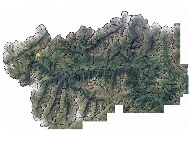
Abstract: Strato che riporta i perimetri degli eventi valanghivi censiti durante le stagioni invernali.
-
Language: Italian
-
Character set: UTF-8, 8-bit variable size UCS Transfer Format
-
Thumbnail:
-
-
-
???catalog.schedaMetadati.thumbnail.url: https://metadati.partout.it/metadata_images/CatastoValanghe_09_10.jpg
-
???catalog.schedaMetadati.thumbnail.type: jpg
-
???catalog.schedaMetadati.thumbnail.description: large_thumbnail
-
Information:
-
Title: Catasto valanghe: Valanghe
-
Date:
-
-
Date 2011-09-30
-
Date Type Creation Date
-
Date:
-
-
Date 2024-02-29
-
Date Type Revision Date
-
Resource responsible:
-
Organization name: Regione Autonoma Valle d'Aosta
-
Role: Owner
-
Contact Info:
-
Phone: 0165 272501
-
E-mail: u-cartografia@regione.vda.it
-
Website: https://geoportale.regione.vda.it
-
Organization name: RAVDA - Ufficio Valanghe
-
Role: Author
-
Contact Info:
-
Phone: 0165 776810
-
E-mail: u-valanghe@regione.vda.it
-
Website: https://www.regione.vda.it
-
Contact point:
-
-
Organization name: RAVDA - Ufficio Cartografico
-
Role: Point Of Contact
-
Contact Info:
-
Phone: 0165 272501
-
E-mail: u-cartografia@regione.vda.it
-
Website: https://geoportale.regione.vda.it
-
Presentation format: mapDigital
-
Update frequency: Annually
-
Type of spatial representation: Vectorial data
-
ISO topic categories:
- environment
-
Keywords:
-
-
Keyword: Condizioni atmosferiche
-
Keyword: Impianti di monitoraggio ambientale
-
Keyword: Zone a rischio naturale
-
Thesaurus:
-
Title: GEMET - INSPIRE themes, version 1.0
-
Date:
-
-
Date 2008-06-01
-
Date Type Publication Date
-
Keyword: protezione dalle valanghe
-
Thesaurus:
-
Title: GEMET - Concepts, version 2.4
-
Date:
-
-
Date 2019-01-28
-
Date Type Publication Date
-
Keyword: Regionale
-
Thesaurus:
-
Title: Spatial scope
-
Date:
-
-
Date 2019-05-22
-
Date Type Publication Date
-
Keyword: EU
-
Geographical area:
-
-
West Bounding Longitude 6.7979
-
East Bounding Longitude 7.9459
-
North Bounding Latitude 45.9932
-
South Bounding Latitude 45.4583
-
Temporal Extent:
-
-
Begin Date 2012-01-01
-
End Date 2030-12-31
-
Legal Constraints:
-
-
Access Contraints:
-
Other Constraints:
-
Legal Constraints:
-
-
Usage Constraints: Other Restrictions
-
Other Constraints: https://sct-outil.regione.vda.it/SCTProfessional/static/pdf/CC_BY_Repertorio_SCT_Outil_v3.pdf
Distribution
-
Distribution Format:
-
-
Format Name geo+json
-
Format Version 1.0
-
Transfer Options:
-
-
URL: https://mappe.partout.it/pub/GeoNavSCT/?metadato=MTD26N2510
-
Distributor:
-
-
Distributor Contact:
-
-
Organization name: Ufficio Cartografico - Centro Diffusione Conoscenze Territoriali
-
Role: Distributor
-
Contact Info:
-
Phone: 0165 272501
-
E-mail: u-cartografia@regione.vda.it
-
Website: https://geoportale.regione.vda.it/
Quality
-
Quality level: Dataset
-
Conformity:
-
-
Conformity Level: Not evaluated
-
Description: Fare riferimento alle specifiche indicate
-
Conformity:
-
-
Title: REGOLAMENTO (UE) N. 1089/2010 DELLA COMMISSIONE del 23 novembre 2010 recante attuazione della direttiva 2007/2/CE del Parlamento europeo e del Consiglio per quanto riguarda l'interoperabilità dei set di dati territoriali e dei servizi di dati territoriali
-
Date:
-
-
Date 2010-12-08
-
Date Type Publication Date
-
Positional accuracy:
-
-
Value: m 1.00 m
-
Lineage: Il Catasto Regionale Valanghe è lo strumento in cui dai primi anni Settanta si aggiorna, inverno dopo inverno, la storia delle valanghe osservate sulle montagne valdostane.Riporta in cartografia esclusivamente le valanghe realmente accadute e documentate e non pone vincoli all'uso del suolo in relazione al pericolo di valanga (vincoli posti esclusivamente dalle cartografie degli ambiti inedificabili quando vengono redatte secondo la lagge regionale 11-1998 art.37).Le informazioni ottenute da interpretazione fotografica, rilievi in campo effettuati con gps, georeferenziazione di fotografie scattate da elicottero, sono integrate, dove possibile, con i modelli 7 AINEVA (Associazione Interregionale Neve e Valanghe) compilati a cura del Corpo forestale della Valle d’Aosta e dei tecnici dell’Ufficio neve e valanghe.