Visualizza questa pagina nel portale RNDT
Information on Metadata
-
File Identifier: r_vda:01429-META:20160908:170943
-
Metadata Language: Italian
-
Metadata Character Set utf8
-
Parent ID: r_vda:01429-META:20160908:170943
-
Hierarchy level: Dataset
-
???catalog.mdParam.rndt.general.hierarchyLevelName Dataset
-
Metadata Responsibile:
-
Organization name: RAVDA - Ufficio Cartografico
-
Role: Point Of Contact
-
Contact Info:
-
Phone: 0165 272501
-
E-mail: u-cartografia@regione.vda.it
-
Website: https://geoportale.regione.vda.it
-
Metadata Date Stamp: 2022-09-12
-
Standard name: Linee Guida RNDT
-
Standard version: 2.0
Reference System Information
-
Reference System Information: ED50-UTM32N
Data information
-
Identifier: r_vda:01429-DATA
-
Series ID: r_vda:01429-DATA
-
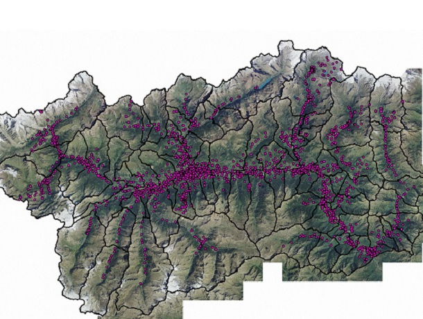
Abstract: Punti di installazione delle cabine secondarie di trasformazione dell’energia da media a bassa tensione.
-
Language: Italian
-
Character set: UTF-8, 8-bit variable size UCS Transfer Format
-
Thumbnail:
-
-
-
???catalog.schedaMetadati.thumbnail.url: https://metadati.partout.it/metadata_images/Cabine_LineeElettricheMT.jpg
-
???catalog.schedaMetadati.thumbnail.type: JPG
-
???catalog.schedaMetadati.thumbnail.description: large_thumbnail
-
Information:
-
Title: Infrastrutture: Linee elettriche di media tensione - Cabine Media Tensione
-
Date:
-
-
Date 2013-02-01
-
Date Type Publication Date
-
Date:
-
-
Date 2022-09-12
-
Date Type Revision Date
-
Resource responsible:
-
Organization name: Regione Autonoma Valle d'Aosta
-
Role: Owner
-
Contact Info:
-
Phone: 0165 272501
-
E-mail: u-cartografia@regione.vda.it
-
Website: https://geoportale.regione.vda.it
-
Organization name: RAVDA - Valutazioni, autorizzazioni ambientali e qualità dell'aria
-
Role: Author
-
Contact Info:
-
Phone: 0165 272140
-
E-mail: s-valambearia@regione.vda.it
-
Website: https://www.regione.vda.it
-
Contact point:
-
-
Organization name: RAVDA - Ufficio Cartografico
-
Role: Point Of Contact
-
Contact Info:
-
Phone: 0165 272501
-
E-mail: u-cartografia@regione.vda.it
-
Website: https://geoportale.regione.vda.it
-
Presentation format: mapDigital
-
Update frequency: Not planned
-
Type of spatial representation: Vectorial data
-
Equivalent Scale: 1: 10000
-
ISO topic categories:
- utilities - Communication
-
Keywords:
-
-
Keyword: Risorse energetiche
-
Thesaurus:
-
Title: GEMET - INSPIRE themes, version 1.0
-
Date:
-
-
Date 2008-06-01
-
Date Type Publication Date
-
Keyword: linee elettriche
-
Thesaurus:
-
Title: GEMET - Concepts, version 2.4
-
Date:
-
-
Date 2019-01-28
-
Date Type Publication Date
-
Keyword: Regionale
-
Thesaurus:
-
Title: Spatial scope
-
Date:
-
-
Date 2019-05-22
-
Date Type Publication Date
-
Keyword: mappa_privata
-
Keyword: EU
-
Geographical area:
-
-
West Bounding Longitude 6.7979
-
East Bounding Longitude 7.9459
-
North Bounding Latitude 45.4583
-
South Bounding Latitude 45.4583
-
Temporal Extent:
-
-
Begin Date 2012-01-01
-
End Date 2030-12-31
-
Legal Constraints:
-
-
Access Contraints:
-
Other Constraints:
-
Legal Constraints:
-
-
Usage Constraints: Other Restrictions
-
Other Constraints: Ad uso esclusivo dell'amministrazione regionale e degli enti locali.
Distribution
-
Distribution Format:
-
-
Format Name geo+json
-
Format Version Shape
-
Transfer Options:
-
-
URL: https://mappe.partout.it/pa/GeoNavSCTpa/?metadato=MTD7N2412
-
Distributor:
-
-
Distributor Contact:
-
-
Organization name: Ufficio Cartografico - Centro Diffusione Conoscenze Territoriali
-
Role: Distributor
-
Contact Info:
-
Phone: 0165 272501
-
E-mail: u-cartografia@regione.vda.it
-
Website: https://geoportale.regione.vda.it
Quality
-
Quality level: Dataset
-
Conformity:
-
-
Conformity Level: Not evaluated
-
Description: Fare riferimento alle specifiche indicate
-
Conformity:
-
-
Title: REGOLAMENTO (UE) N. 1089/2010 DELLA COMMISSIONE del 23 novembre 2010 recante attuazione della direttiva 2007/2/CE del Parlamento europeo e del Consiglio per quanto riguarda l'interoperabilità dei set di dati territoriali e dei servizi di dati territoriali
-
Date:
-
-
Date 2010-12-08
-
Date Type Publication Date
-
Positional accuracy:
-
-
Value: m 1 m
-
Lineage: La cartografia è stata realizzata sulla CTRN e ortofoto in scala 10.000. Il quadro normativo di riferimento è costituito dalle leggi: A) L. 22 febbraio 2001, n. 36 (Legge quadro sulla protezione dalle esposizioni a campi elettrici, magnetici, elettromagnetici), articolo 7 (Catasto Nazionale) e articolo 8, comma 1, lettera d) che introduce i catasti regionali. B) L.r. 15 dicembre 2006, n. 32 (Disposizioni in materia di elettrodotti). C)L.r. 28 aprile 2011, n. 8 (Nuove disposizioni in materia di elettrodotti. Abrogazione della legge regionale 15 dicembre 2006, n. 32).