Visualizza questa pagina nel portale RNDT
Information on Metadata
-
File Identifier: r_umbria:00000:20190619:163000
-
Metadata Language: Italian
-
Metadata Character Set
utf8
-
Parent ID: r_umbria:00000:20190619:163000
-
Hierarchy level: Dataset
-
???catalog.mdParam.rndt.general.hierarchyLevelName Dataset
-
Metadata Responsibile:
-
Organization name: Regione Umbria - SIAT
-
Role: Point Of Contact
-
Contact Info:
-
E-mail:
umbriageo@regione.umbria.it
-
Website: http://www.umbriageo.regione.umbria.it
-
Metadata Date Stamp: 2019-06-19
-
Standard name: Linee Guida RNDT
-
Standard version: 2.0
Reference System Information
-
Reference System Information: RDN2008-TM33NE
Data information
-
Identifier: r_umbria:00000:20190619:163000
-
Series ID: r_umbria:00000:20190619:163000
-
Abstract: Il dataset GRID statistico è stato realizzato a partire dalla griglia 1 kmq della popolazione GEOSTAT 2011, lanciata in cooperazione con l'European Forum for Geography and Statistics (EFGS) e messa a disposizione da EUROSTAT. I grids sono stati proiettati nel sistema ETRF2000 - UTM 33N (EPSG: 6708). Nel tracciato record è presente un valore che esprime la percentuale di incidenza della superficie del territorio della Regione Umbria rispetto alla superficie della cella. Sono presenti 4 livelli di grid: 100x100 m, 500x500 m, 1x1 km, 5x5 km.
-
Language: Italian
-
Character set: UTF-8, 8-bit variable size UCS Transfer Format
-
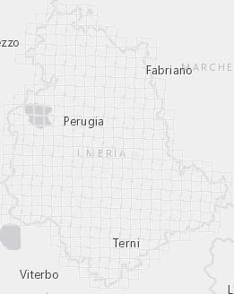
Thumbnail:
-
-
-
???catalog.schedaMetadati.thumbnail.url: http://geo.umbriaterritorio.it/umbriageo/Thumbnail/grid_statistico.JPG
-
Information:
-
Title: Grid statistico – Umbria
-
Date:
-
-
Date 2019-06-19
-
Date Type Creation Date
-
Resource responsible:
-
Organization name: Regione Umbria
-
Role: Owner
-
Contact Info:
-
E-mail:
umbriageo@regione.umbria.it
-
Website: http://www.umbriageo.regione.umbria.it
-
Contact point:
-
-
Organization name: Regione Umbria - SIAT
-
Role: Point Of Contact
-
Contact Info:
-
E-mail:
umbriageo@regione.umbria.it
-
Website: http://www.umbriageo.regione.umbria.it
-
Presentation format: mapDigital
-
Update frequency: Not planned
-
Type of spatial representation: Vectorial data
-
Equivalent Scale: 1:
1000
-
ISO topic categories:
- boundaries
- imagery BaseMaps EarthCover
-
Keywords:
-
-
Keyword: Unità statistiche
-
Thesaurus:
-
Title: GEMET - INSPIRE themes, version 1.0
-
Date:
-
-
Date 2008-06-01
-
Date Type Publication Date
-
Keyword: confini
-
Keyword: geografia
-
Thesaurus:
-
Title: GEMET - Concepts, version 2.4
-
Date:
-
-
Date 2019-01-28
-
Date Type Publication Date
-
Keyword: Regionale
-
Thesaurus:
-
Title: Spatial scope
-
Date:
-
-
Date 2019-05-22
-
Date Type Publication Date
-
Keyword: grid
-
Keyword: Eurostat
-
Keyword: Istat
-
Keyword: Regione Umbria
-
Keyword: grid statistico
-
Keyword: celle
-
Keyword: open data
-
Keyword: EU
-
Geographical area:
-
-
West Bounding Longitude 11.8918873189186
-
East Bounding Longitude 13.2641895503866
-
North Bounding Latitude 43.6173443846477
-
South Bounding Latitude 42.3644489025728
-
Use Limitation: L'accesso e la fruibilità del dato sono pubblici (Dato pubblico)
-
Legal Constraints:
-
-
Access Contraints:
-
Other Constraints:
-
Legal Constraints:
-
-
Usage Constraints: Other Restrictions
-
Other Constraints: Licenza Creative Commons CC-BY https://creativecommons.org/licenses/by/4.0/
Distribution
-
Distribution Format:
-
-
Format Name
x-shapefile
-
Format Version
-
-
Transfer Options:
-
-
URL: https://siat.regione.umbria.it/arcgis/services/GRID/Grids_statistico/MapServer/WFSServer?request=GetCapabilities&service=WFS
-
Transfer Options:
-
-
URL: http://geo.umbriaterritorio.it/umbriageo/grid_statistico/GRID_STATISTICO_SHP.zip
-
Distributor:
-
-
Distributor Contact:
-
-
Organization name: Regione Umbria - SIAT
-
Role: Distributor
-
Contact Info:
-
E-mail:
umbriageo@regione.umbria.it
-
Website: http://www.umbriageo.regione.umbria.it
Quality
-
Quality level: Dataset
-
Conformity:
-
-
Conformity Level: Not evaluated
-
Description: Fare riferimento alle specifiche indicate
-
Conformity:
-
-
Title: REGOLAMENTO (UE) N. 1089/2010 DELLA COMMISSIONE del 23 novembre 2010 recante attuazione della direttiva 2007/2/CE del Parlamento europeo e del Consiglio per quanto riguarda l'interoperabilità dei set di dati territoriali e dei servizi di dati territoriali
-
Date:
-
-
Date 2010-12-08
-
Date Type Publication Date
-
Positional accuracy:
-
-
Value:
m
100
m
-
Lineage: I grid sono stati proiettati nel sistema ETRF2000 - UTM 33N (EPSG:6708). Nel tracciato record è presente un valore che esprime la percentuale di incidenza della superficie del territorio della Regione Umbria rispetto alla superficie della cella. Sono presenti 4 livelli di grid: 100x100 m, 500x500 m, 1x1 km, 5x5 km.