Visualizza questa pagina nel portale RNDT
Information on Metadata
-
File Identifier: r_toscan:f84d49e5-0cb8-4293-9ebc-4d12a58d6479
-
Metadata Language: Italian
-
Metadata Character Set utf8
-
Hierarchy level: Dataset
-
Metadata Responsibile:
-
Organization name: Regione Toscana - Settore Sistema Informativo e Pianificazione del Territorio
-
Role: Point Of Contact
-
Contact Info:
-
E-mail: contatto.cartografia@regione.toscana.it
-
Website:
-
Metadata Date Stamp: 2025-05-08
-
Standard name: Linee Guida RNDT
-
Standard version: 2.0
Reference System Information
-
Reference System Information: Monte-Mario-Italy1
Data information
-
Identifier: r_toscan:f84d49e5-0cb8-4293-9ebc-4d12a58d6479
-
Series ID: r_toscan:f84d49e5-0cb8-4293-9ebc-4d12a58d6479
-
Abstract: Individuazione delle aree ammesse all'intervento SRA ACA18 "Impegni per l'Apicoltura” PSP 2023-2027. La perimetrazione è stata approvata con Delibera di Giunta Regionale n. 1285 del 11-11-2024 e Decreto Dirigenziale n. 26131 del 26-11-2024.
-
Language: Italian
-
Character set: UTF-8, 8-bit variable size UCS Transfer Format
-
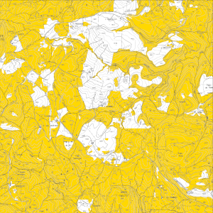
Thumbnail:
-
-
-
???catalog.schedaMetadati.thumbnail.url: https://www502.regione.toscana.it:/geonetwork/srv/api/records/r_toscan:f84d49e5-0cb8-4293-9ebc-4d12a58d6479/attachments/rt178%20ACA18%20f84.png
-
???catalog.schedaMetadati.thumbnail.description: rt178 ACA18 f84.png
-
Information:
-
Title: Regione Toscana - Aree ammesse all'intervento SRA - ACA18 "Impegni per l'Apicoltura” PSP 2023-2027
-
Date:
-
-
Date 2024-10-04
-
Date Type Creation Date
-
Date:
-
-
Date 2024-10-04
-
Date Type Publication Date
-
Date:
-
-
Date 2024-10-04
-
Date Type Revision Date
-
Resource responsible:
-
Organization name: Regione Toscana
-
Role: Owner
-
Contact Info:
-
E-mail: urp@regione.toscana.it
-
Website:
-
Contact point:
-
-
Organization name: Regione Toscana - Settore Sistema Informativo e Pianificazione del Territorio
-
Role: Point Of Contact
-
Contact Info:
-
E-mail: contatto.cartografia@regione.toscana.it
-
Website:
-
Organization name: Regione Toscana - SETTORE "Produzioni agricole, vegetali e zootecniche. Promozione. Sostegno agli investimenti delle imprese agricole e agroalimentari"
-
Role: Point Of Contact
-
Contact Info:
-
Phone:
-
E-mail: riccardo.buti@regione.toscana.it
-
Website:
-
Presentation format: mapDigital
-
Type of spatial representation: Vectorial data
-
Equivalent Scale: 1: 10000
-
ISO topic categories:
- farming
-
Keywords:
-
-
Keyword: EU
-
Keyword: Zone sottoposte a gestione/limitazioni/regolamentazione e unità con obbligo di comunicare dati
-
Keyword: Impianti agricoli e di acquacoltura
-
Thesaurus:
-
Title: GEMET - INSPIRE themes, version 1.0
-
Date:
-
-
Date 2008-06-01
-
Date Type Publication Date
-
Keyword: opendata
-
Keyword: PSP
-
Keyword: Aree ammesse alla misura ACA 18
-
Keyword: RNDT
-
Keyword: Regionale
-
Thesaurus:
-
Title: Spatial scope
-
Date:
-
-
Date 2019-05-22
-
Date Type Publication Date
-
Keyword: agricoltura
-
Keyword: apicoltura
-
Thesaurus:
-
Title: GEMET
-
Date:
-
-
Date 2018-08-16
-
Date Type Publication Date
-
Geographical area:
-
-
West Bounding Longitude 9.59
-
East Bounding Longitude 12.46
-
North Bounding Latitude 44.45
-
South Bounding Latitude 42.24
-
Other details and supplemental information:
-
Cod.RT: 178 - ACA18 - f84
-
Use Limitation: no conditions apply
-
Legal Constraints:
-
-
Access Contraints:
-
Other Constraints:
-
Legal Constraints:
-
-
Usage Constraints: Other Restrictions
-
Other Constraints: La risorsa è liberamente accessibile e usabile con licenza CC BY
Distribution
-
Distribution Format:
-
-
Format Name ESRI Shapefile
-
Format Version 1.0
-
Transfer Options:
-
-
URL: https://www502.regione.toscana.it/geoscopio/cartoteca.html
-
Transfer Options:
-
-
URL: https://www502.regione.toscana.it/geoscopio/csr-feasr23-27.html
-
Transfer Options:
-
-
URL: https://www502.regione.toscana.it/wmsraster/com.rt.wms.RTmap/wms?map=owsareeapicoltura&language=ita&;
-
Distributor:
-
-
Distributor Contact:
-
-
Organization name: Regione Toscana - Settore Sistema Informativo e Pianificazione del Territorio
-
Role: Distributor
-
Contact Info:
-
E-mail: contatto.cartografia@regione.toscana.it
-
Website:
Quality
-
Quality level: Dataset
-
Conformity:
-
-
Conformity Level: Not evaluated
-
Description: Fare riferimento alle specifiche indicate
-
Conformity:
-
-
Title: REGOLAMENTO (UE) N. 1089/2010 DELLA COMMISSIONE del 23 novembre 2010 recante attuazione della direttiva 2007/2/CE del Parlamento europeo e del Consiglio per quanto riguarda l'interoperabilità dei set di dati territoriali e dei servizi di dati territoriali
-
Date:
-
-
Date 2010-12-08
-
Date Type Publication Date
-
Positional accuracy:
-
-
Value: m 2.5 m
-
Lineage: I poligoni delle aree di intervento ammissibili per l’ubicazione degli apiari sono stati individuati nell'ambito del LPIS (Land Parcel Identification System), di cui al regolamento Reg. (CE) 2-12-2021 n. 2021/2116/UE e attuativi Reg. (CE) 31-5-2022 n. 2022/1173/UE e Reg.(CE) 4-5-2022 n. 2022/1172/UE (fonte ARTEA), e corrispondono a quelli individuati all’interno della classificazione relativa al Refresh – Aggiornamento del SIPA-AGEA VI ciclo da cui sono stati estratti mediante query i seguenti codici:638-PRATO PERMANENTE (SENZA TARA).650-BOSCHI,654-PASCOLO MAGRO (TARA 50%),659-PASCOLO MAGRO (TARA 20%)Il layer fa riferimento alla Delibera di Giunta Regionale n. 1285 del 11-11-2024 e Decreto Dirigenziale n. 26131 del 26-11-2024.