Visualizza questa pagina nel portale RNDT
Information on Metadata
-
File Identifier: r_toscan:ca590840-facb-4913-9075-28c6bc673781
-
Metadata Language: Italian
-
Metadata Character Set utf8
-
Hierarchy level: Dataset
-
Metadata Responsibile:
-
Organization name: Regione Toscana - Settore Sistema Informativo e Pianificazione del Territorio
-
Role: Point Of Contact
-
Contact Info:
-
E-mail: contatto.cartografia@regione.toscana.it
-
Website:
-
Metadata Date Stamp: 2025-01-14
-
Standard name: Linee Guida RNDT
-
Standard version: 2.0
Reference System Information
-
Reference System Information: Monte-Mario-Italy1
Data information
-
Identifier: r_toscan:ca590840-facb-4913-9075-28c6bc673781
-
Series ID: r_toscan:ca590840-facb-4913-9075-28c6bc673781
-
Abstract: Ricognizione, nel Piano di Indirizzo Territoriale con valenza di Piano Paesaggistico (PIT-PPR) della Regione Toscana, degli immobili ed aree di notevole interesse pubblico di cui all’art.136 del D.Lgs 42/2004 (Codice). Il Piano Paesaggistico, in attuazione dell’art. 143, comma 1, lettera b) del Codice comprende la ricognizione degli immobili e delle aree dichiarati di notevole interesse pubblico, la loro delimitazione e rappresentazione cartografica. I vincoli di cui all'art.136 del D.lgs 42/2004 sono stati successivamente recepiti dal PIT-PPR della Regione Toscana con Deliberazione Consiglio Regionale n. 37/2015.
-
Language: Italian
-
Character set: UTF-8, 8-bit variable size UCS Transfer Format
-
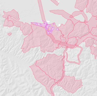
Thumbnail:
-
-
-
???catalog.schedaMetadati.thumbnail.url: https://www502.regione.toscana.it/geonetwork/srv/api/records/r_toscan:ca590840-facb-4913-9075-28c6bc673781/attachments/rt078%20Tutela136%20ca5.png
-
???catalog.schedaMetadati.thumbnail.description: rt078%20Tutela136%20ca5.png
-
Information:
-
Title: Regione Toscana - Immobili ed aree di notevole interesse pubblico - art.136 D.Lgs 42/2004 - valido fino ad agosto 2019
-
Date:
-
-
Date 2015-01-01
-
Date Type Creation Date
-
Resource responsible:
-
Organization name: Regione Toscana
-
Role: Owner
-
Contact Info:
-
E-mail: urp@regione.toscana.it
-
Website:
-
Organization name: Regione Toscana - Tutela, riqualificazione e valorizzazione del paesaggio
-
Role: Point Of Contact
-
Contact Info:
-
Phone:
-
E-mail: domenicobartolo.scrascia@regione.toscana.it
-
Website:
-
Contact point:
-
-
Organization name: Regione Toscana - Settore Sistema Informativo e Pianificazione del Territorio
-
Role: Point Of Contact
-
Contact Info:
-
E-mail: contatto.cartografia@regione.toscana.it
-
Website:
-
Presentation format: mapDigital
-
Type of spatial representation: Vectorial data
-
Equivalent Scale: 1: 10000
-
ISO topic categories:
- planning - Cadastre
-
Keywords:
-
-
Keyword: EU
-
Keyword: RNDT
-
Keyword: Siti protetti
-
Thesaurus:
-
Title: GEMET - INSPIRE themes, version 1.0
-
Date:
-
-
Date 2008-06-01
-
Date Type Publication Date
-
Keyword: opendata
-
Keyword: Regionale
-
Thesaurus:
-
Title: Spatial scope
-
Date:
-
-
Date 2019-05-22
-
Date Type Publication Date
-
Keyword: protezione dei siti
-
Keyword: area di protezione del paesaggio
-
Thesaurus:
-
Title: GEMET
-
Date:
-
-
Date 2018-08-16
-
Date Type Publication Date
-
Geographical area:
-
-
West Bounding Longitude 9.59
-
East Bounding Longitude 12.46
-
North Bounding Latitude 44.45
-
South Bounding Latitude 42.24
-
Other details and supplemental information:
-
Cod.RT: 78 - Tutela136 - ca5
-
Use Limitation: no conditions apply
-
Legal Constraints:
-
-
Access Contraints:
-
Other Constraints:
-
Legal Constraints:
-
-
Usage Constraints: Other Restrictions
-
Other Constraints: La risorsa è liberamente accessibile e usabile con licenza CC BY
Distribution
-
Distribution Format:
-
-
Format Name ESRI Shapefile
-
Format Version 1.0
-
Transfer Options:
-
-
URL: https://www502.regione.toscana.it/geoscopio/pianopaesaggistico.html
-
Distributor:
-
-
Distributor Contact:
-
-
Organization name: Regione Toscana - Settore Sistema Informativo e Pianificazione del Territorio
-
Role: Distributor
-
Contact Info:
-
E-mail: contatto.cartografia@regione.toscana.it
-
Website:
Quality
-
Quality level: Dataset
-
Conformity:
-
-
Conformity Level: Not evaluated
-
Description: Fare riferimento alle specifiche indicate
-
Conformity:
-
-
Title: REGOLAMENTO (UE) N. 1089/2010 DELLA COMMISSIONE del 23 novembre 2010 recante attuazione della direttiva 2007/2/CE del Parlamento europeo e del Consiglio per quanto riguarda l'interoperabilità dei set di dati territoriali e dei servizi di dati territoriali
-
Date:
-
-
Date 2010-12-08
-
Date Type Publication Date
-
Positional accuracy:
-
-
Value: m 2.5 m
-
Lineage: Il dataset è stato prodotto, in collaborazione con Consorzio LaMMA, sulla base dei provvedimenti ministeriali istitutivi dei vincoli attraverso una lettura contemporanea della parte testuale di ciascun decreto e della planimetria allegata, in riferimento agli elementi di confine. Il dataset è stato creato attraverso la trasposizione cartografica in dato vettoriale georeferenziato delle perimetrazioni come individuate da decreto, utilizzando come base cartografica la CTR alla scala 1:10.000 e come cartografie accessorie la Cartografia Catastale e le Tavolette IGM alla scala 1:25.000.