Visualizza questa pagina nel portale RNDT
Information on Metadata
-
File Identifier: r_toscan:a84380ed-d415-4989-b4c5-bf5427518610
-
Metadata Language: Italian
-
Metadata Character Set utf8
-
Hierarchy level: Dataset
-
Metadata Responsibile:
-
Organization name: Regione Toscana - Settore Sistema Informativo e Pianificazione del Territorio
-
Role: Point Of Contact
-
Contact Info:
-
E-mail: contatto.cartografia@regione.toscana.it
-
Metadata Date Stamp: 2025-02-06
-
Standard name: Linee Guida RNDT
-
Standard version: 2.0
Reference System Information
-
Reference System Information: RDN2008 / UTM zone 32N
Data information
-
Identifier: r_toscan:a84380ed-d415-4989-b4c5-bf5427518610
-
Series ID: r_toscan:a84380ed-d415-4989-b4c5-bf5427518610
-
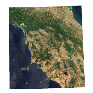
Abstract: Mosaico regionale stagionale basato su immagini Sentinel-2, prodotto semestralmente relativamente ai periodi Dicembre-Febbraio e Maggio-Luglio. Vengono proposti due tipi di combinazioni, RGB (B4, B3, B2) e Falsi Colori (B8, B4, B3).
-
Language: Italian
-
Character set: UTF-8, 8-bit variable size UCS Transfer Format
-
Thumbnail:
-
-
-
???catalog.schedaMetadati.thumbnail.url: https://www502.regione.toscana.it/geonetwork/srv/api/records/r_toscan:a84380ed-d415-4989-b4c5-bf5427518610/attachments/rt148%20Sentinel2M%20a84.png
-
???catalog.schedaMetadati.thumbnail.description: rt148 Sentinel2M a84.png
-
Information:
-
Title: Regione Toscana - Sentinel2 Multispettrale
-
Date:
-
-
Date 2023-05-17
-
Date Type Creation Date
-
Date:
-
-
Date 2023-05-17
-
Date Type Publication Date
-
Date:
-
-
Date 2023-05-17
-
Date Type Revision Date
-
Resource responsible:
-
Organization name: Regione Toscana
-
Role: Owner
-
Contact Info:
-
E-mail: urp@regione.toscana.it
-
Contact point:
-
-
Organization name: Regione Toscana - Settore Sistema Informativo e Pianificazione del Territorio
-
Role: Point Of Contact
-
Contact Info:
-
E-mail: contatto.cartografia@regione.toscana.it
-
Presentation format: imageDigital
-
Type of spatial representation: Raster data
-
ISO topic categories:
- imagery BaseMaps EarthCover
- planning - Cadastre
-
Keywords:
-
-
Keyword: Copertura del suolo
-
Keyword: Orto immagini
-
Thesaurus:
-
Title: GEMET - INSPIRE themes, version 1.0
-
Date:
-
-
Date 2008-06-01
-
Date Type Publication Date
-
Keyword:
-
Thesaurus:
-
Title: Registro dei dati di interesse generale per il RNDT
-
Date:
-
-
Date 2018-06-25
-
Date Type Publication Date
-
Keyword: EU
-
Keyword: RNDT
-
Keyword: opendata
-
Keyword: Regionale
-
Thesaurus:
-
Title: Spatial scope
-
Date:
-
-
Date 2019-05-22
-
Date Type Publication Date
-
Keyword: satellite artificiale
-
Keyword: satellite
-
Keyword: scanner multispettrale
-
Keyword: immagine da satellite
-
Thesaurus:
-
Title: GEMET
-
Date:
-
-
Date 2018-08-16
-
Date Type Publication Date
-
Geographical area:
-
-
West Bounding Longitude 9.58
-
East Bounding Longitude 12.70
-
North Bounding Latitude 44.65
-
South Bounding Latitude 42.20
-
Other details and supplemental information:
-
Cod.RT: 148 - Sentinel2M - a84
-
Use Limitation: Nessuna condizione applicabile
-
Legal Constraints:
-
-
Access Contraints:
-
Other Constraints:
-
Legal Constraints:
-
-
Usage Constraints: Other Restrictions
-
Other Constraints: La risorsa è liberamente accessibile e usabile con licenza CC BY
Distribution
-
Distribution Format:
-
-
Format Name TIFF
-
Format Version 1.0
-
Transfer Options:
-
-
URL: https://www502.regione.toscana.it/geoscopio/immagini_satellite.html
-
Distributor:
-
-
Distributor Contact:
-
-
Organization name: Regione Toscana - Settore Sistema Informativo e Pianificazione del Territorio
-
Role: Distributor
-
Contact Info:
-
E-mail: contatto.cartografia@regione.toscana.it
Quality
-
Quality level: Dataset
-
Conformity:
-
-
Conformity Level: Not evaluated
-
Description: non valutato
-
Conformity:
-
-
Title: REGOLAMENTO (UE) N. 1089/2010 DELLA COMMISSIONE del 23 novembre 2010 recante attuazione della direttiva 2007/2/CE del Parlamento europeo e del Consiglio per quanto riguarda l'interoperabilità dei set di dati territoriali e dei servizi di dati territoriali
-
Date:
-
-
Date 2010-12-08
-
Date Type Publication Date
-
Positional accuracy:
-
-
Value: m 10 m
-
Lineage: Per la creazione dei mosaici sono state utilizzate immagini ortorettificate e corrette atmosfericamente (valori di riflettanza alla superficie, Level 2A), filtrate per ottenere una copertura nuvolosa possibilmente inferiore al 10%. Sono state utilizzate le bande B2 (Blue; λ centrale 490 nm), B3 (Green; λ centrale 560 nm), B4 (Red; λ centrale 665 nm) e B8 (NIR; λ centrale 842 nm).