Visualizza questa pagina nel portale RNDT
Information on Metadata
-
File Identifier: r_toscan:7cc8d94c-980a-4c4f-91e5-78fdbfc6618e
-
Metadata Language: Italian
-
Metadata Character Set utf8
-
Hierarchy level: Dataset
-
Metadata Responsibile:
-
Organization name: Regione Toscana - Settore Sistema Informativo e Pianificazione del Territorio
-
Role: Point Of Contact
-
Contact Info:
-
E-mail: contatto.cartografia@regione.toscana.it
-
Metadata Responsibile:
-
Organization name: Regione Toscana - Ufficio Regionale Territoriale Pistoia
-
Role: Point Of Contact
-
Contact Info:
-
E-mail: marco.ferretti@regione.toscana.it
-
Metadata Date Stamp: 2025-01-14
-
Standard name: Linee Guida RNDT
-
Standard version: 2.0
Reference System Information
-
Reference System Information: Monte-Mario-Italy1
Data information
-
Identifier: r_toscan:7cc8d94c-980a-4c4f-91e5-78fdbfc6618e
-
Series ID: r_toscan:7cc8d94c-980a-4c4f-91e5-78fdbfc6618e
-
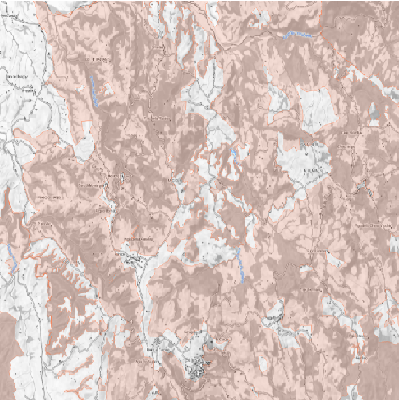
Abstract: Aree Vocate al Cinghiale della Regione Toscana art. 6bis Legge regionale 12 gennaio 1994, n. 3 Recepimento della Legge 11 febbraio 1992, n.157 "Norme per la protezione della fauna selvatica omeoterma e per il prelievo venatorio", approvate con Delibera di Consiglio Regionale n. 77 del 01/08/2018
-
Language: Italian
-
Character set: UTF-8, 8-bit variable size UCS Transfer Format
-
Thumbnail:
-
-
-
???catalog.schedaMetadati.thumbnail.url: https://www502.regione.toscana.it/geonetwork/srv/api/records/r_toscan:7cc8d94c-980a-4c4f-91e5-78fdbfc6618e/attachments/rt041%20PfvAVC%20.png
-
???catalog.schedaMetadati.thumbnail.description: rt041%20PfvAVC%20.png
-
Information:
-
Title: Regione Toscana - Aree Vocate al Cinghiale 2018 art. 17bis L.R. 3/94
-
Date:
-
-
Date 2018-08-22
-
Date Type Creation Date
-
Date:
-
-
Date 2018-08-22
-
Date Type Publication Date
-
Date:
-
-
Date 2018-08-22
-
Date Type Revision Date
-
Resource responsible:
-
Organization name: Regione Toscana
-
Role: Owner
-
Contact Info:
-
E-mail: urp@regione.toscana.it
-
Organization name: Regione Toscana - Ufficio Regionale Territoriale Pistoia
-
Role: Principal Investigator
-
Contact Info:
-
E-mail: marco.ferretti@regione.toscana.it
-
Contact point:
-
-
Organization name: Regione Toscana - Settore Sistema Informativo e Pianificazione del Territorio
-
Role: Point Of Contact
-
Contact Info:
-
E-mail: contatto.cartografia@regione.toscana.it
-
Organization name: Regione Toscana - Ufficio Regionale Territoriale Pistoia
-
Role: Point Of Contact
-
Contact Info:
-
E-mail: marco.ferretti@regione.toscana.it
-
Presentation format: mapDigital
-
Type of spatial representation: Vectorial data
-
Equivalent Scale: 1: 10000
-
ISO topic categories:
- farming
- planning - Cadastre
-
Keywords:
-
-
Keyword: EU
-
Keyword: RNDT
-
Keyword: Utilizzo del territorio
-
Keyword: Impianti agricoli e di acquacoltura
-
Thesaurus:
-
Title: GEMET - INSPIRE themes, version 1.0
-
Date:
-
-
Date 2008-06-01
-
Date Type Publication Date
-
Keyword: opendata
-
Keyword: Regionale
-
Thesaurus:
-
Title: Spatial scope
-
Date:
-
-
Date 2019-05-22
-
Date Type Publication Date
-
Keyword: uso del territorio
-
Keyword: acquacoltura
-
Keyword: pianificazione ambientale
-
Thesaurus:
-
Title: GEMET
-
Date:
-
-
Date 2018-08-16
-
Date Type Publication Date
-
Geographical area:
-
-
West Bounding Longitude 9.59
-
East Bounding Longitude 12.46
-
North Bounding Latitude 44.45
-
South Bounding Latitude 42.24
-
Other details and supplemental information:
-
Cod.RT: 41 - PfvAVC - 7cc
-
Use Limitation: no conditions apply
-
Legal Constraints:
-
-
Access Contraints:
-
Other Constraints:
-
Legal Constraints:
-
-
Usage Constraints: Other Restrictions
-
Other Constraints: La risorsa è liberamente accessibile e usabile con licenza CC BY
Distribution
-
Distribution Format:
-
-
Format Name ESRI Shapefile
-
Format Version 1.0
-
Transfer Options:
-
-
URL: https://www502.regione.toscana.it/geoscopio/cartoteca.html
-
Distributor:
-
-
Distributor Contact:
-
-
Organization name: Regione Toscana - Settore Sistema Informativo e Pianificazione del Territorio
-
Role: Distributor
-
Contact Info:
-
E-mail: contatto.cartografia@regione.toscana.it
Quality
-
Quality level: Dataset
-
Conformity:
-
-
Conformity Level: Not evaluated
-
Description: Fare riferimento alle specifiche indicate
-
Conformity:
-
-
Title: REGOLAMENTO (UE) N. 1089/2010 DELLA COMMISSIONE del 23 novembre 2010 recante attuazione della direttiva 2007/2/CE del Parlamento europeo e del Consiglio per quanto riguarda l'interoperabilità dei set di dati territoriali e dei servizi di dati territoriali
-
Date:
-
-
Date 2010-12-08
-
Date Type Publication Date
-
Positional accuracy:
-
-
Value: m 2.5 m
-
Lineage: Il presente file vettoriale e' stato prodotto in funzione di quanto approvato con Delibera di Consiglio Regionale n. 77 del 01/08/2018, secondo quanto previsto art. 6bis Legge regionale 12 gennaio 1994, n. 3 Recepimento della Legge 11 febbraio 1992, n.157 "Norme per la protezione della fauna selvatica omeoterma e per il prelievo venatorio"