Visualizza questa pagina nel portale RNDT
Information on Metadata
-
File Identifier: r_toscan:698f7bb0-936a-4149-810b-7b87bcb1d140
-
Metadata Language: Italian
-
Metadata Character Set utf8
-
Hierarchy level: Dataset
-
Metadata Responsibile:
-
Organization name: Regione Toscana - Settore Sistema Informativo e Pianificazione del Territorio
-
Role: Point Of Contact
-
Contact Info:
-
E-mail: contatto.cartografia@regione.toscana.it
-
Metadata Date Stamp: 2025-01-14
-
Standard name: Linee Guida RNDT
-
Standard version: 2.0
Reference System Information
-
Reference System Information: Monte-Mario-Italy1
Data information
-
Identifier: r_toscan:698f7bb0-936a-4149-810b-7b87bcb1d140
-
Series ID: r_toscan:96547242-8229-4537-862c-14d593e7102e
-
Abstract: Progetto HASCITU (HAbitat in the Sites of Community Importance in Tuscany). Banca dati geografica integrabile nel Sistema informativo territoriale e ambientale (SITA) della Regione Toscana riguardante i dati distributivi degli habitat meritevoli di conservazione secondo la Direttiva "Habitat" n. 92/43/CEE presenti nelle ZSC della Regione Toscana. Il dataset e' stato approvato con DGR n. 505 del 15/05/2018.
-
Language: Italian
-
Character set: UTF-8, 8-bit variable size UCS Transfer Format
-
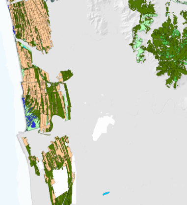
Thumbnail:
-
-
-
???catalog.schedaMetadati.thumbnail.url: https://www502.regione.toscana.it/geonetwork/srv/api/records/r_toscan:698f7bb0-936a-4149-810b-7b87bcb1d140/attachments/rt024%20Hasitu%20698%20.png
-
???catalog.schedaMetadati.thumbnail.description: rt024%20Hasitu%20698%20.png
-
Information:
-
Title: Regione Toscana - HASCITU - Habitat in SIC della Toscana
-
Date:
-
-
Date 2017-10-31
-
Date Type Creation Date
-
Date:
-
-
Date 2018-05-15
-
Date Type Publication Date
-
Resource responsible:
-
Organization name: Regione Toscana
-
Role: Owner
-
Contact Info:
-
E-mail: urp@regione.toscana.it
-
Organization name: Universita' di Firenze - Dipartimento di Biologia
-
Role: Principal Investigator
-
Contact Info:
-
E-mail: bruno.foggi@unifi.it
-
Organization name: Centro Interuniversitario di Scienze del Territorio
-
Role: Owner
-
Contact Info:
-
E-mail: bruno.foggi@unifi.it
-
Contact point:
-
-
Organization name: Regione Toscana - Settore Tutela della Natura e del Mare
-
Role: Point Of Contact
-
Contact Info:
-
E-mail: parchiareeprotette_biodiversita@regione.toscana.it
-
Organization name: Universita' di Firenze - Dipartimento di Biologia
-
Role: Point Of Contact
-
Contact Info:
-
E-mail: bruno.foggi@unifi.it
-
Presentation format: mapDigital
-
Type of spatial representation: Vectorial data
-
Equivalent Scale: 1: 10000
-
ISO topic categories:
- biota
- environment
-
Keywords:
-
-
Keyword: EU
-
Keyword: RNDT
-
Keyword: Utilizzo del territorio
-
Keyword: Siti protetti
-
Keyword: Habitat e biotopi
-
Thesaurus:
-
Title: GEMET - INSPIRE themes, version 1.0
-
Date:
-
-
Date 2008-06-01
-
Date Type Publication Date
-
Keyword: opendata
-
Keyword: Regionale
-
Thesaurus:
-
Title: Spatial scope
-
Date:
-
-
Date 2019-05-22
-
Date Type Publication Date
-
Keyword: protezione dell'ambiente
-
Keyword: protezione dei siti
-
Keyword: biologia
-
Thesaurus:
-
Title: GEMET
-
Date:
-
-
Date 2018-08-16
-
Date Type Publication Date
-
Geographical area:
-
-
West Bounding Longitude 9.59
-
East Bounding Longitude 12.46
-
North Bounding Latitude 44.45
-
South Bounding Latitude 42.24
-
Other details and supplemental information:
-
Cod.RT: 24 - Hascitu - 698
-
Use Limitation: no conditions apply
-
Legal Constraints:
-
-
Access Contraints:
-
Other Constraints:
-
Legal Constraints:
-
-
Usage Constraints: Other Restrictions
-
Other Constraints: La risorsa è liberamente accessibile e usabile con licenza CC BY
Distribution
-
Distribution Format:
-
-
Format Name ESRI Shapefile
-
Format Version 1.0
-
Transfer Options:
-
-
URL: https://www502.regione.toscana.it/geoscopio/arprot.html
-
Transfer Options:
-
-
URL: https://www502.regione.toscana.it/geoscopio/download/tematici/aree_protette/habitat_hascitu.zip
-
Distributor:
-
-
Distributor Contact:
-
-
Organization name: Regione Toscana - Settore Sistema Informativo e Pianificazione del Territorio
-
Role: Distributor
-
Contact Info:
-
E-mail: contatto.cartografia@regione.toscana.it
Quality
-
Quality level: Dataset
-
Conformity:
-
-
Conformity Level: Not evaluated
-
Description: Fare riferimento alle specifiche indicate
-
Conformity:
-
-
Title: REGOLAMENTO (UE) N. 1089/2010 DELLA COMMISSIONE del 23 novembre 2010 recante attuazione della direttiva 2007/2/CE del Parlamento europeo e del Consiglio per quanto riguarda l'interoperabilità dei set di dati territoriali e dei servizi di dati territoriali
-
Date:
-
-
Date 2010-12-08
-
Date Type Publication Date
-
Positional accuracy:
-
-
Value: m 2.5 m
-
Lineage: Reperimento delle informazioni disponibili: bibliografiche, relazioni tecniche, cartografie e materiale inedito. Acquisizione della carta dell'uso del suolo 2010/2013 alla scala 1:10.000. Omogeneizzazione delle informazioni.Interpretazione delle ortofoto piu' aggiornate per meglio definire i confini delle principali tipologie vegetazionali e/o fisionomiche. Sopralluoghi in corso d'opera per rilievo degli habitat e controllo dei dati fotointerpretati. Elaborazione della carta finale degli habitat rappresentati come unita' a se' stanti o in mosaico.