Visualizza questa pagina nel portale RNDT
Information on Metadata
-
File Identifier: r_piemon:4368c018-6b58-4834-b233-c45360cb1206
-
Metadata Language: Italian
-
Metadata Character Set utf8
-
Hierarchy level: Dataset
-
Metadata Responsibile:
-
Organization name: CSI Piemonte
-
Role: Point Of Contact
-
Contact Info:
-
Phone:
-
E-mail: info-geoportale@regione.piemonte.it
-
Website: http://www.csipiemonte.it
-
Metadata Date Stamp: 2025-10-06
-
Standard name: Linee Guida RNDT
-
Standard version: 2.0
Reference System Information
-
Reference System Information: WGS84/UTM 32N
Data information
-
Identifier: r_piemon:4368c018-6b58-4834-b233-c45360cb1206
-
Series ID: r_piemon:4368c018-6b58-4834-b233-c45360cb1206
-
Abstract: Dati identificativi delle aree protette individuate per caratteristiche naturali, paesaggistiche e culturali, e definite mediante specifici atti legislativi. Il dataset contiene le aree protette nazionali, regionali e altre tipologie di aree facenti parte della Rete Ecologica Regionale. Le singole aree protette sono classificate secondo le tipologie previste dal titolo II, capo I, della legge regionale 29 giugno 2009 n. 19 e s.m.i. “Testo unico sulla tutela delle aree naturali e della biodiversità” che prevede, in relazione alle diverse caratteristiche e destinazioni d’uso, l'individuazione di Parchi naturali, Riserve naturali, Riserve speciali, Aree contigue e Zone naturali di salvaguardia. Per i parchi regionali sono inoltre indicati i soggetti preposti alla loro gestione (Ente di gestione, Provincia, ecc...). L'obiettivo di tutela di questi siti è la conservazione della natura. I siti sono designati secondo la normativa IUCN.
-
Language: Italian
-
Character set: UTF-8, 8-bit variable size UCS Transfer Format
-
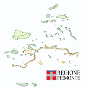
Thumbnail:
-
-
-
???catalog.schedaMetadati.thumbnail.url: https://www.geoportale.piemonte.it/geonetwork/srv/api/records/r_piemon:4368c018-6b58-4834-b233-c45360cb1206/attachments/anteprima_aree_protette_s.png
-
???catalog.schedaMetadati.thumbnail.type: png
-
???catalog.schedaMetadati.thumbnail.description: thumbnail
-
Information:
-
Title: Aree protette e altre aree tutelate
-
Date:
-
-
Date 1992-01-01
-
Date Type Creation Date
-
Date:
-
-
Date 2024-05-27
-
Date Type Revision Date
-
Date:
-
-
Date 2025-07-31
-
Date Type Revision Date
-
Resource responsible:
-
Organization name: Regione Piemonte - A1601D - Biodiversità e aree naturali
-
Role: Custodian
-
Contact Info:
-
Phone:
-
E-mail: biodiversita@regione.piemonte.it
-
Website: https://www.regione.piemonte.it/web/temi/ambiente-territorio/biodiversita-aree-naturali
-
Organization name: Regione Piemonte
-
Role: Owner
-
Contact Info:
-
Phone:
-
E-mail: info-geoportale@regione.piemonte.it
-
Website: https://www.regione.piemonte.it
-
Contact point:
-
-
Organization name: Regione Piemonte - A1601D - Biodiversità e aree naturali
-
Role: Point Of Contact
-
Contact Info:
-
Phone:
-
E-mail: biodiversita@regione.piemonte.it
-
Website: https://www.regione.piemonte.it/web/temi/ambiente-territorio/biodiversita-aree-naturali
-
Presentation format: mapDigital
-
Update frequency: When needed
-
Type of spatial representation: Vectorial data
-
Equivalent Scale: 1: 10000
-
ISO topic categories:
- environment
-
Keywords:
-
-
Keyword: opendata
-
Keyword: aree protette
-
Keyword: rete
-
Keyword: Siti protetti
-
Thesaurus:
-
Title: GEMET - INSPIRE themes, version 1.0
-
Date:
-
-
Date 2008-06-01
-
Date Type Publication Date
-
Keyword: RNDT
-
Keyword: EU
-
Keyword: Regionale
-
Thesaurus:
-
Title: Spatial scope
-
Date:
-
-
Date 2019-05-22
-
Date Type Publication Date
-
Keyword: Nationally designated areas - CDDA
-
Thesaurus:
-
Title: INSPIRE priority data set
-
Date:
-
-
Date 2018-04-04
-
Date Type Publication Date
-
Keyword: ambiente (in generale)
-
Keyword: pianificazione
-
Keyword: riserva naturale
-
Keyword: conservazione della natura
-
Keyword: parco naturale
-
Keyword: protezione della natura
-
Keyword: ecosistema
-
Keyword: patrimonio naturale
-
Thesaurus:
-
Title: GEMET GEneral Multilingual Environmental Thesaurus
-
Date:
-
-
Date 2023-01-21
-
Date Type Publication Date
-
Geographical area:
-
-
West Bounding Longitude 6.62
-
East Bounding Longitude 9.21
-
North Bounding Latitude 46.459999084472656
-
South Bounding Latitude 44.06
-
Other details and supplemental information:
- L. 394/91 - LR 19/2009
-
Legal Constraints:
-
-
Access Contraints:
-
Other Constraints:
-
Legal Constraints:
-
-
Usage Constraints: Other Restrictions
-
Other Constraints: https://creativecommons.org/licenses/by/4.0/deed.it
Distribution
-
Distribution Format:
-
-
Format Name ESRI Shape
-
Format Version N.A.
-
Transfer Options:
-
-
URL: https://geomap.reteunitaria.piemonte.it/ws/gsareprot/rp-01/areeprotwfs/wfs_gsareprot_1?service=WFS&version=2.0&request=getCapabilities
-
Transfer Options:
-
-
URL: https://geomap.reteunitaria.piemonte.it/ws/gsareprot/rp-01/areeprotwms/wms_gsareprot_1?service=wms&version=1.3.0&request=getCapabilities
-
Transfer Options:
-
-
URL: https://www.datigeo-piem-download.it/direct/Geoportale/RegionePiemonte/Aree_protette/parchi_wgs84.zip
-
Transfer Options:
-
-
URL: https://www.datigeo-piem-download.it/direct/Geoportale/RegionePiemonte/Aree_protette/Aree_contigue_Piemonte.zip
-
Transfer Options:
-
-
URL: https://www.datigeo-piem-download.it/direct/Geoportale/RegionePiemonte/Aree_protette/Aree_protette_Piemonte.zip
-
Distributor:
-
-
Distributor Contact:
-
-
Organization name: CSI Piemonte
-
Role: Distributor
-
Contact Info:
-
Phone:
-
E-mail: info-geoportale@regione.piemonte.it
-
Website: http://www.csipiemonte.it
Quality
-
Quality level: Dataset
-
Conformity:
-
-
Conformity Level: Not evaluated
-
Description: Fare riferimento alle specifiche indicate
-
Conformity:
-
-
Title: REGOLAMENTO (UE) N. 1089/2010 DELLA COMMISSIONE del 23 novembre 2010 recante attuazione della direttiva 2007/2/CE del Parlamento europeo e del Consiglio per quanto riguarda l'interoperabilità dei set di dati territoriali e dei servizi di dati territoriali
-
Date:
-
-
Date 2010-12-08
-
Date Type Publication Date
-
Positional accuracy:
-
-
Value: m 4 m
-
Lineage: 1990 – 1996 acquisizione delimitazione aree protette per lo più su CTR 1:10.000, per qualche caso su IGM 1:25.000, ed in fine per pochi casi su mappe catastali. - IPLA - Istituto per le Piante da Legno e l'Ambiente - CSI Piemonte - Regione Piemonte Febbraio 2002 - dicembre 2009 Aggiunta nuovi parchi e aggiornamento limiti riportando tutti i confini su CTR 1:10.000 -IPLA - Istituto per le Piante da Legno e l'Ambiente - CSI Piemonte - Regione Piemonte Dicembre 2011 –Aggiornamento generale e acquisizione di nuove geometrie alla scala 1:10.000 - Regione Piemonte - IPLA - Istituto per le Piante da Legno e l'Ambiente - CSI PiemonteAprile 2019 –Aggiornamento e acquisizione di nuove geometrie alla scala 1:10.000 - Regione Piemonte - CSI PiemonteGennaio 2021 – Aggiornamento e acquisizione di nuove geometrie alla scala 1:10.000 - Regione Piemonte - CSI PiemonteMaggio 2024 - Aggiornamento e acquisizione di nuove geometrie alla scala 1:10.000 - Regione Piemonte - CSI Piemonte